In 2021, Mexico City opened two aerial cable car lines as a mass-transit solution for neighborhoods the Metro never reached. The system is called the Cablebús, operated by the city's Servicio de Transportes Eléctricos (STE), and it was designed for working-class commuters in the hills of Gustavo A. Madero to the north and the dense boroughs of Iztapalapa to the east. A third line opened in September 2024, crossing the forest of Chapultepec toward Santa Fe in the west. None of the lines appear on standard tourist maps. This is partly why they're worth knowing about: for 7 pesos, you get an aerial view of the real city — the parts that house over half the population and that most visitors to Condesa and Roma never see except through a taxi window. The gondola cabins are enclosed, hold eight passengers, and move at a steady 6 meters per second. They run continuously like a conveyor — no scheduled departures. Tap your Tarjeta MI card at the turnstile, board, and the cabin slides out over the city. The whole system is, by any practical measure, excellent public infrastructure that doubles as one of the most interesting urban experiences in Latin America.
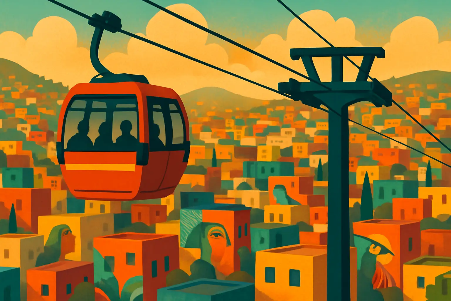
Line 2 is the one you take first. It holds the Guinness World Record for the longest urban gondola lift at 10.6 kilometers, running from Metro Constitución de 1917 (on Metro Line A) in the south through the borough of Iztapalapa to Santa Marta station in the east. The full end-to-end ride takes about 45 minutes and passes through six stations: Constitución de 1917, Quetzalcóatl, Las Torres Buenavista, Xalpa, Lomas de la Estancia, San Miguel Teotongo, and Santa Marta. Somewhere in the middle of the route — roughly between Quetzalcóatl and Xalpa — the cable gains serious elevation, and the flat rooftops of Iztapalapa's grid begin to reveal themselves as a giant outdoor gallery. Since 2018, a government arts program called Iztapalapa Mural has commissioned over 900 murals on rooftops and building facades along the cable route, painted by 40 artists working in themes of migration, indigenous identity, women's roles, and local craftsmanship. From 30 meters up, you see murals you could never photograph from street level — massive works covering entire rooftops, only visible from the air. The effect is somewhere between a magic trick and a museum. Take this line on a clear morning before 11 a.m., sit on the side facing the murals as you climb, and give the ride your full attention. Within five minutes you'll understand why this line has a quiet but devoted following among the travelers who have found it.
Get short, interactive stories that make each place easier to remember while you travel.
Line 1 is less visually dramatic than Line 2 but more genuinely off the beaten path. It runs 9.2 kilometers from Indios Verdes — where Metro Lines 3 and 6 terminate at the northern edge of the city — into the hillside neighborhoods of Gustavo A. Madero, one of Mexico City's most populous and least-visited boroughs. The line splits at Campos Revolución into two branches: one toward Cuautepec station and one toward Tlalpexco station. Below, you see brick constructions climbing steep hillsides, water tanks, rooftop laundry lines, and the broad basin of the city spreading south. On a clear day — especially in November and December after the rains have scrubbed the air — you can see Popocatépetl and Iztaccíhuatl rising above the southern horizon from this line, the two active volcanoes that frame the city's skyline. Each direction from Campos Revolución takes about 20 minutes. Line 1 is best understood as the full-commitment local experience: board at Indios Verdes, ride to Cuautepec, and ride back without getting off. The neighborhoods at the far end are dense and residential — not hostile, but there are no cafes or tourist infrastructure to walk toward. This line rewards people who want to see a version of Mexico City that even many chilangos from Roma or Polanco have never visited.
Line 3, the newest addition (inaugurated September 2024), is the most visitor-friendly of the three — which is to say it starts somewhere you might already be going. The boarding point on the east end is Los Pinos/Constituyentes, adjacent to the former presidential residence (now an open cultural complex with 24 museums and galleries) at the edge of Chapultepec Forest. The line runs 5.5 kilometers west across all four sections of Bosque de Chapultepec, passing above old-growth trees, the historic Panteón de Dolores cemetery (one of the city's oldest and largest), the Charrería arena, and the Cineteca Nacional's forest campus before ending at Vasco de Quiroga in the Santa Fe financial district. The total ride takes 21 minutes. From above Chapultepec, you're looking down at a forest canopy covering 686 hectares inside a city of 22 million people — an absurd fact that becomes viscerally real when you float above the treetops and realize you can't see where the city resumes. Line 3 is the easy intro: if you're already spending time at Chapultepec Park, this is a worthwhile 7-peso detour that gives you an angle on the forest you won't get from any walking path inside it.
The Cablebús requires a Tarjeta de Movilidad Integrada — universally called the Tarjeta MI or simply 'la tarjeta.' This is the same rechargeable card used for the Metro, Metrobús, Tren Ligero, and all other public transit in Mexico City. You cannot pay cash at the Cablebús turnstile. Buy the card at any Metro station — look for the booths marked 'Venta de Tarjetas' near the turnstiles. The card itself costs 20 pesos (about $1 USD, a one-time fee you never pay again). Each Cablebús ride costs 7 pesos. Metro rides cost 5 pesos. You load money onto the card in any amount at the same Metro booths or at dedicated recharge kiosks inside stations. The card does not expire and can be reloaded indefinitely. For anyone staying in Mexico City more than a couple of days, 100 to 200 pesos on a Tarjeta MI covers a week of Metro and Cablebús rides combined. Beyond its utility, the card communicates something important in crowded transit: having it out and ready means you move with purpose, which is always the right posture at Mexico City transit stations.
Line 2 (Iztapalapa): The ideal window is Saturday or Sunday between 9 and 11 a.m. Morning light hits the rooftop murals at the best angle for visibility, and the cabins are lighter on weekends. The practical half-day: take Metro Line A to Constitución de 1917 (transfer at Pantitlán from most of the center), board the Cablebús, ride end-to-end to Santa Marta, and ride back. Total time runs about 90 minutes including the Metro. If you want lunch after, exit back at Constitución de 1917 and walk the commercial streets around the Metro station — there are taquerías de guisado and comida corrida spots every half-block, priced for local commuters, not tourists. Avoid the afternoon rush (5 to 8 p.m. on weekdays) if you want uncrowded cabins. Line 3 (Chapultepec): Works well any day after 9 a.m. but before early afternoon. During rainy season (June through October), the afternoon showers — usually arriving between 3 and 5 p.m. — lower visibility and make for a less interesting ride; plan Line 3 for morning. Board at Los Pinos on the east end after your Chapultepec visit; the terminal is a 10-minute walk from the main Chapultepec Metro entrance along Avenida Constituyentes.
Is the ride itself safe? Yes. The gondola infrastructure on all three lines is manufactured by Doppelmayr, an Austrian company that operates cable systems on six continents. The cars are modern, enclosed, and run on a continuous loop — no moving parts exposed to passengers. You're in a sealed cabin with commuters: families, students, people going to work. What about the neighborhoods below? Lines 1 and 2 cross through areas unfamiliar to most tourists. The Cablebús ride does not put you in any neighborhood — you're 30 meters up in a sealed gondola. The safety question only applies if you plan to exit at intermediate stations. For most visitors, the move is to ride end-to-end without disembarking at stops that aren't the main terminals. Do I need anything besides the Tarjeta MI? No. Tap in, board, ride. Can I bring a stroller or large bag? Yes — the cabins accommodate backpacks, groceries, and the normal cargo of daily commuters. Operating hours: Monday–Friday 5 a.m.–11 p.m., Saturday 6 a.m.–11 p.m., Sunday 7 a.m.–11 p.m. across all lines, year-round. During heavy rain, the enclosed cabins mean the Cablebus keeps running while pedestrian visibility on the street below drops to near zero.