Route 66 Explained: The 2,400-Mile Road That Mapped the American Century
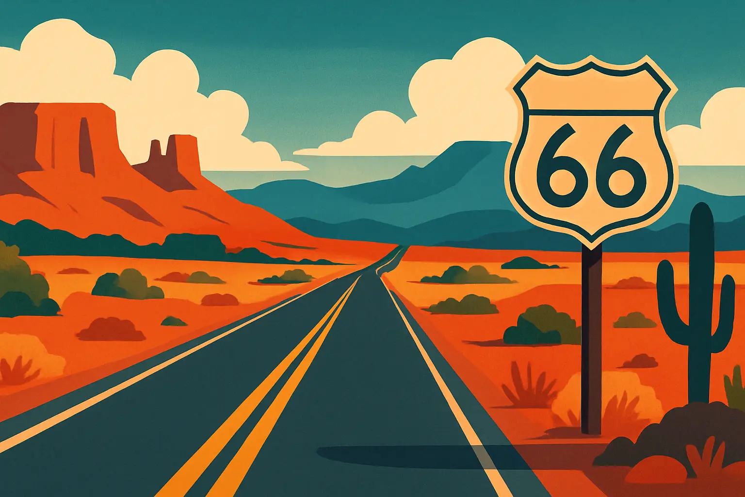
Here is a counterintuitive fact about Route 66: the road was decommissioned in 1985, removed from every official federal map, and replaced by interstate highways that are objectively faster and smoother — and yet more people drive it today than at virtually any point during its operational life. That tension between obsolescence and mythology is precisely what makes Route 66 worth understanding. The road ran 2,448 miles from **Chicago, Illinois** to **Santa Monica, California**, linking the industrial Midwest to the Pacific Coast through eight states: Illinois, Missouri, Kansas, Oklahoma, Texas, New Mexico, Arizona, and California. Established in 1926, it was one of the original highways in the U.S. numbered highway system, designed not for romance but for commerce — a logical grid line connecting small farming and ranching communities to regional markets. What transformed it into an icon was a sequence of catastrophic and triumphant American events: the Dust Bowl migration of the 1930s, World War II troop movements, the postwar economic boom that put two cars in every driveway, and ultimately the Interstate Highway Act of 1956, which began the road's long, slow erasure. This article traces all of it — the history, the mythology, the architecture, and what a traveler can actually experience today.
🗽 Short stories • Collectible cards • Learn as you travel
Begin in Chicago at the official eastern terminus marker on East Adams Street near Michigan Avenue in the Loop. Parking garages nearby run $15–$25/day. From here, most drivers head southwest toward Joliet, Illinois, a 30-mile stretch with several intact 1940s diners and roadside motels still operating.
Avoid the interstate entirely
Navigation apps default to I-40 through much of the Southwest. Before departure, download the free Historic Route 66 Association maps (available at route66.org) or load the EV66 GPS layer, which traces the surviving road. Without it, you'll miss detours through Seligman, Arizona, and Adrian, Texas — two of the most intact original stretches.
Peak season and pricing
May through mid-June and September through October offer the best driving conditions. Summer in the Mojave Desert (July–August) regularly hits 110°F, making breakdowns genuinely dangerous. Budget motels on surviving Route 66 stretches in New Mexico and Arizona run $65–$110/night; restored motor courts like the Blue Swallow Motel in Tucumcari, NM ($89–$130/night) book out weeks in advance during peak season.
The complete Route 66 history and travel guide
1How a federal highway numbering decision in 1926 created an American legend
Route 66 did not emerge from romance. It emerged from bureaucracy. In 1925, the American Association of State Highway Officials was tasked with creating a numbered national highway system, replacing the chaotic patchwork of named trails — the Lincoln Highway, the Ozark Trails, the National Old Trails Road — that crisscrossed the country with overlapping routes and inconsistent surfaces. Cyrus Avery, an Oklahoma businessman and state highway commissioner, lobbied aggressively for a diagonal highway that would run from Chicago through his home state down to the Southwest. He succeeded, and U.S. Route 66 was formally certified on November 11, 1926, though large sections of it remained unpaved until 1938.
The routing itself was economically motivated. Avery wanted the highway to pass through Tulsa, his home city, rather than taking a more direct southern arc through Texas. His lobbying shaped the road's famous diagonal logic — why it dips south through Oklahoma and the Texas panhandle before swinging west through New Mexico and Arizona rather than following a more obvious geographic line.
For its first decade, Route 66 was primarily a commercial artery serving agricultural communities. It connected grain farmers in Illinois and Missouri to cattle ranchers in Oklahoma, copper miners in Arizona, and the emerging citrus and film industries in Southern California. Small towns along the route — Joliet, Springfield, Joplin, Amarillo, Flagstaff — grew their economies around travelers who needed fuel, food, and beds.
The road's character changed permanently between 1930 and 1940, when an estimated 200,000 to 500,000 people fled the Dust Bowl states of Oklahoma, Texas, and Kansas, driving west toward California in overloaded vehicles. John Steinbeck immortalized this migration in *The Grapes of Wrath* (1939), calling Route 66 'the mother road, the road of flight' — a phrase that lodged in the American imagination and never left. By the time Steinbeck wrote those words, the road had already accumulated a human weight that no highway engineering study could have predicted.
2The Dust Bowl migration: why Route 66 became the road of flight
Between 1930 and 1936, a combination of severe drought and decades of aggressive farming stripped topsoil from roughly 100 million acres across the southern Great Plains. The resulting dust storms — some visible from 2,000 miles away — destroyed crops, killed livestock, and made large portions of Oklahoma, Texas, Kansas, and the Oklahoma Panhandle essentially uninhabitable. Families who had mortgaged everything on wheat harvests suddenly had nothing.
Route 66 was the only paved road heading west. It became the literal escape route for what historians estimate was between 200,000 and 500,000 migrants, most from Oklahoma (giving rise to the pejorative 'Okie'), who packed into cars and trucks to reach California's Central Valley, where farmwork was rumored to be plentiful. The reality was grimmer: California growers exploited the labor surplus, paying starvation wages, and local communities met migrants with hostility. The Los Angeles Police Department briefly established 'bum blockades' at the California border in 1936 to turn back migrants.
The physical evidence of this migration is still traceable along Route 66. In Shamrock, Texas, the U-Drop Inn (now a Conoco station and National Historic Landmark, open daily at 4501 U.S. Route 66) opened in 1936 specifically to serve westward-bound travelers. In Needles, California, near the Arizona border, the road descends from the Mojave heat into the Colorado River valley — a point migrants described in letters as their first moment of relief. The California Route 66 Museum in Victorville (16825 D Street, open Thursday–Monday, 10am–4pm, admission $5) maintains a permanent exhibition on the migration, including original photographs by Dorothea Lange taken for the Farm Security Administration.
What the Dust Bowl migration gave Route 66 was moral weight. It was no longer just an economic corridor. It was the road Americans took when they had no other options, which meant it carried all the complexity of American failure and resilience simultaneously.
Keep touring
Discover more about United States in minutes
Get short, interactive stories that make each place easier to remember while you travel.
3The postwar golden age: car culture, motels, and roadside Americana
If the 1930s defined Route 66 as a road of necessity, the late 1940s and 1950s redefined it as a road of pleasure. Returning World War II veterans, flush with GI Bill benefits and suppressed consumer demand, bought cars in record numbers. General Motors alone sold 1.5 million vehicles in 1949. Route 66, now fully paved and well-signed, became the primary corridor for westward family vacations, particularly to California, which had acquired a near-mythological status as a land of sunshine and possibility.
The road's commercial ecosystem exploded to meet this demand. Motor courts — the precursor to the modern motel — lined every small-town approach. These were clusters of individual cabins arranged in a U-shape around a central office, allowing drivers to park directly outside their room, a radical convenience compared to traditional hotels. By 1950, Route 66 alone had hundreds of motor courts; survivors like the Blue Swallow Motel in Tucumcari, New Mexico (815 E Route 66, rooms from $89/night), and the Wigwam Motel in Holbrook, Arizona (811 W Hopi Drive, rooms from $75/night) are now listed on the National Register of Historic Places and remain operational.
Roadside architecture became aggressively theatrical. The Cadillac Ranch installation near Amarillo, Texas — ten Cadillacs buried nose-down in a wheat field by the art collective Ant Farm in 1974 — became the road's most photographed landmark. The Blue Hole in Santa Rosa, New Mexico, a circular natural pool 60 feet wide and 80 feet deep used by travelers as a swimming stop, still draws thousands of visitors. Drive-in theaters, curio shops selling 'genuine' Native American jewelry of variable authenticity, and diners shaped like hats, windmills, and rockets competed for drivers' attention and dollars.
Bobby Troup's 1946 song '(Get Your Kicks on) Route 66,' recorded first by Nat King Cole and later by the Rolling Stones and dozens of others, codified the road's pleasure-seeking identity. The CBS television series *Route 66* (1960–1964) carried the mythology further, though ironically it was filmed largely on roads other than Route 66 itself.
4The Interstate Highway Act and the road's long decline
The legislation that killed Route 66 was signed into law on June 29, 1956, by President Dwight D. Eisenhower, who had been inspired — and frustrated — by the German Autobahn system he encountered during World War II. The Federal-Aid Highway Act of 1956 authorized $25 billion (approximately $280 billion in 2024 dollars) to construct 41,000 miles of limited-access interstate highways across the United States. The rationale was partly military — the interstates were designed to allow rapid troop movements and civilian evacuation in case of nuclear attack — and partly economic.
For Route 66, the consequences were slow and devastating. Interstate 55 paralleled the road through Illinois. I-44 superseded it through Missouri and Oklahoma. Interstate 40, which replaced Route 66 through the Southwest, was the killing blow for dozens of small towns. When I-40 bypassed Seligman, Arizona, by a few miles in 1978, the town lost almost all of its through-traffic virtually overnight. Angel Delgadillo, a barber who had operated his shop on Route 66 in Seligman since 1950, organized local business owners in 1987 — two years after the road's official decommissioning — to form the Historic Route 66 Association of Arizona, the first of what became eight state preservation organizations.
The final section of Route 66 to be bypassed was a stretch through Williams, Arizona, replaced by I-40 in October 1984. On October 13, 1984, Arizona Governor Bruce Babbitt ceremonially drove the last mile. The following year, Route 66 was officially decertified as a U.S. highway — its signs removed, its designation voided.
By the late 1980s, entire towns along the former route had been abandoned. Gas stations stood empty, their pumps rusted. Motels with broken neon signs sat unoccupied for years. The decline was particularly acute in Oklahoma and the Texas Panhandle, where small agricultural communities had already been losing population since the 1950s. Route 66 had been their economic lifeline; the interstate bypasses cut it entirely.
5What actually survives: the eight states and their best-preserved stretches
Despite 40 years of bypassing, abandonment, and demolition, roughly 85 percent of the original Route 66 pavement still exists in driveable form across the eight states. Quality and character vary dramatically by state.
Illinois contains the road's most underrated stretch. The 300-mile segment from Chicago to the Missouri border passes through Springfield (the Cozy Dog Drive In at 2935 S 6th Street claims to have invented the corn dog in 1946), Pontiac (home of the free Illinois Route 66 Hall of Fame and Museum at 110 W Howard Street), and dozens of intact 1950s commercial strips.
Missouri offers the Chain of Rocks Bridge near St. Louis, a 1929 bridge with a distinctive 22-degree bend in the middle, now converted to a pedestrian and cycling path. The Meramec Caverns near Stanton have operated as a roadside attraction since 1935 and still advertise on barn roofs along the route.
Oklahoma contains more original Route 66 mileage than any other state — 432 miles — including the intact stretch through Arcadia, home of the Round Barn (built 1898, now a museum) and POPS, a futuristic gas station and soda shop with a 66-foot illuminated soda bottle.
Texas contributes only 178 miles, but they include Cadillac Ranch (accessible year-round, free, just west of Amarillo off I-40 at exit 60) and the restored U-Drop Inn in Shamrock.
New Mexico has the most atmospheric surviving desert stretches, particularly the 100-mile section between Tucumcari and Santa Rosa, where the road passes through near-empty high desert with the original 1930s alignment still intact.
Arizona has the longest uninterrupted surviving stretch in the country: 158 miles from Seligman to Topock, passing through Hackberry, Kingman, and the Oatman ghost town where wild burros wander the streets.
California's final 315 miles include the Mojave Desert crossing through Amboy (population approximately 4), the Wigwam Village echo at Victorville, and the terminus at the Santa Monica Pier, where a small bronze Route 66 end sign marks the official endpoint at the intersection of Lincoln Boulevard and Olympic Boulevard.
6The preservation movement and Route 66's cultural afterlife
The National Historic Route 66 Federation, founded in 1994, coordinates preservation efforts across all eight states and advocates at the federal level for funding to restore surviving roadside structures. In 2023, Congress reauthorized the Route 66 Centennial Commission — established to plan events around the road's 100th anniversary in 2026 — with $10 million in funding for preservation grants.
Preservation has been uneven and sometimes contentious. The Wigwam Motel in Holbrook, Arizona, has been maintained largely by the same family since it opened in 1950 and represents a genuine survival. But critics have noted that some 'restored' Route 66 sites are essentially theme-park recreations, replacing original fabric with new construction that mimics 1950s aesthetics without historical authenticity.
The road's cultural footprint extends far beyond nostalgia tourism. Pixar's 2006 film *Cars* — set in the fictional Radiator Springs, a composite of Seligman and Tucumcari — introduced Route 66 to a generation born decades after its decommissioning. The film's international success triggered a wave of European and Asian tourists driving the route, a trend that has continued and expanded. By 2019, the National Park Service estimated that Route 66 attracted more than 6 million visitors annually, generating over $1.5 billion in economic activity across the eight states.
The road also functions as a living archive of American vernacular architecture. The neon signs that once lit Route 66's commercial strips are now recognized as a distinct design tradition; the Museum of Neon Art in Glendale, California (216 S Brand Blvd, open Thursday–Sunday, $15 admission), maintains a collection that includes restored Route 66 signs. The Preservation Alliance in Albuquerque has documented more than 1,200 surviving Route 66 structures in New Mexico alone.
For travelers interested in American roadside architecture and car culture, Route 66 remains the primary field site in the country — a 2,400-mile open-air museum of 20th-century commercial design, only partially curated and still partially wild.
7Planning your Route 66 trip: logistics, costs, and what to prioritize
A full end-to-end drive from Chicago to Santa Monica takes a minimum of 10 days at a reasonable pace; 14–18 days allows for genuine exploration. Most drivers choose to cover specific states or regions rather than the full route. The highest-density sections for intact landmarks are central Illinois, the Oklahoma panhandle, and the Arizona stretch from Seligman to Kingman.
Seasonal planning:
- May–June (ideal): mild temperatures across all eight states, wildflowers in the Mojave, minimal crowds before July 4 surge
- September–October (excellent): post-monsoon clarity in New Mexico and Arizona, cool nights in the desert
- July–August (challenging): Mojave Desert crossings can reach 110–115°F; always carry extra water and check tire pressure before leaving Las Vegas or Needles
- November–March (variable): Oklahoma and Texas can experience ice storms; New Mexico mountain passes may require chains
Estimated costs for a 14-day full route drive:
- Fuel: $250–$400 depending on vehicle efficiency (the route averages around 2,300 miles of actual driving when following original alignments)
- Accommodation: $900–$1,800 (mix of historic motor courts and budget chains)
- Food: $400–$700 eating primarily at diners and local restaurants along the route
- Attractions and entrance fees: $100–$200 (most roadside sites are free or under $10)
Specific stops not to miss:
- Gemini Giant statue, Wilmington, IL (free, roadside)
- Chain of Rocks Bridge, St. Louis, MO (free pedestrian access)
- Blue Whale of Catoosa, Catoosa, OK (free)
- Cadillac Ranch, Amarillo, TX (free; bring spray paint — it's encouraged)
- Blue Swallow Motel, Tucumcari, NM (book 4–6 weeks ahead in peak season)
- Petrified Forest National Park, AZ ($25/vehicle, directly on the route)
- Santa Monica Pier terminus, Santa Monica, CA (free, parking $3–$12/hour)
Practical apps and resources: The Route 66: The Complete Guidebook by Jerry McClanahan (EZ66 Guide, $24.95) remains the most comprehensive navigation tool. The Historic Route 66 Federation website (route66fed.org) maintains a state-by-state directory of open businesses.
Keep touring
Want to experience Route 66's stories at every stop along the way?
TourMe's Route 66 content includes location-triggered audio stories, collectible landmark cards for iconic stops from the Chain of Rocks Bridge to the Santa Monica Pier terminus, and interactive historical chapters on the Dust Bowl migration and postwar car culture. Each story is researched and narrated so you learn as you drive — no cell signal required for downloaded routes.