United States • History & Culture • Desert Geology
Joshua Tree's Strange Landscape Explained: Two Deserts, One Park
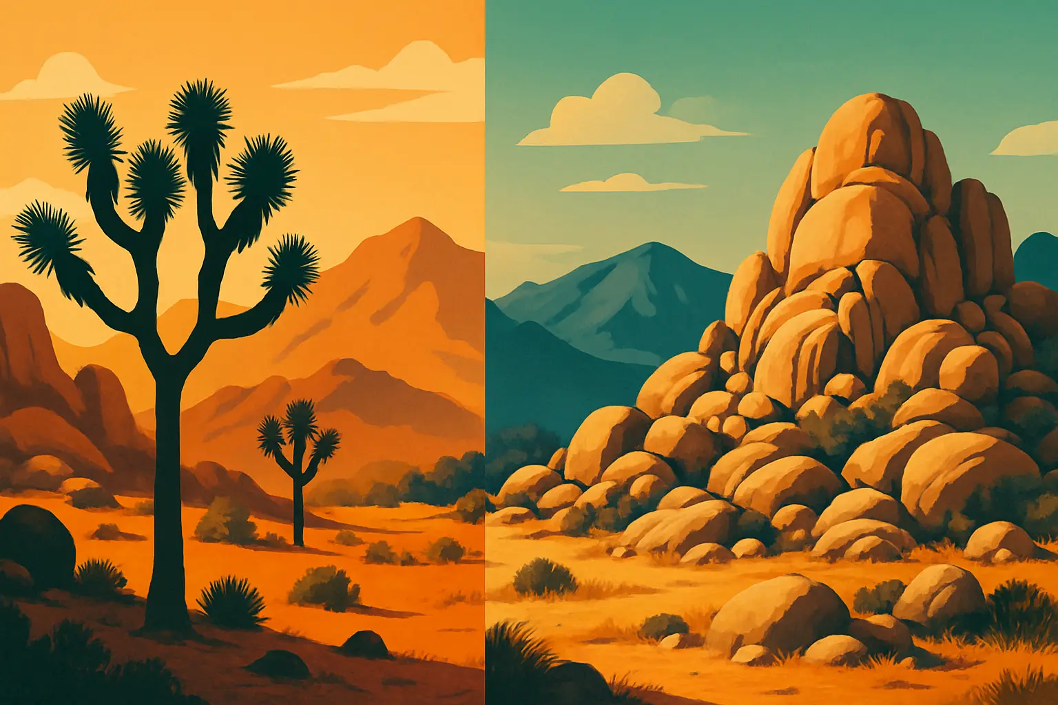
Most visitors assume Joshua Tree National Park is one unified desert. It is not. The park's 1,235 square miles straddle the boundary between two entirely distinct desert ecosystems — the **Mojave Desert** in the west and the **Sonoran Desert** in the east — and the transition between them is abrupt enough that you can feel it while driving east on **Pinto Basin Road**. The air gets hotter. The elevation drops. The dramatic boulder piles give way to flat, sandy flats bristling with **cholla cactus** instead of yucca trees. The Joshua tree, *Yucca brevifolia*, simply stops appearing around the 3,000-foot contour line, as if someone drew a line in the sand — which, geologically speaking, is almost exactly what happened. Understanding why requires going back roughly 100 million years to when the granite boulders that define the park's western half were still molten magma cooling beneath an ancient sea. This guide walks you through the park's geology, its two desert biomes, the peculiar biology of the Joshua tree itself, and what to see and when to go.
🗽 Short stories • Collectible cards • Learn as you travel
October through April offers the most comfortable temperatures. Summer highs in the lower Pinto Basin routinely exceed 110°F (43°C), and the National Park Service strongly discourages hiking between 10 a.m. and 4 p.m. from June through September. Wildflower season peaks in March and early April after a wet winter.
Entrance fees and passes
As of 2025, the vehicle entrance fee is $35, valid for seven days. An America the Beautiful annual pass ($80) covers all 63 national parks and pays for itself after three visits. The two main entry points are the West Entrance Station near the town of Joshua Tree on CA-62, and the North Entrance near Twentynine Palms.
Drive the Geology Tour Road
The 18-mile **Geology Tour Road** off Park Boulevard is a self-guided dirt road (high-clearance vehicles recommended past mile 5) with 16 numbered stops explaining the park's full geological story — from Precambrian metamorphic rock to Quaternary alluvial fans. Pick up the free printed guide at the Oasis Visitor Center, 74485 National Park Drive, Twentynine Palms.
The complete Joshua Tree geology and desert ecosystems guide
1Why two deserts share one park — and why that boundary matters
Joshua Tree became a national monument in 1936 under President Franklin D. Roosevelt, largely through the advocacy of Minerva Hoyt, a Pasadena socialite and horticulturalist who spent years lobbying Washington to protect the Mojave's desert flora from commercial collectors who were stripping Joshua trees and cacti by the truckload for sale to landscapers. It was elevated to full national park status in 1994 under the California Desert Protection Act, the same legislation that also upgraded Death Valley and created Mojave National Preserve.
The park's dual-desert character, however, was baked into its geography long before any legislation. The Mojave and Sonoran Deserts are separated by elevation and temperature regime more than by any visible geological feature. The Mojave is a high-cold desert — its core regions sit between 2,000 and 5,000 feet above sea level and receive occasional winter frost, which is precisely why the Joshua tree, which requires a cold dormancy period to trigger flowering, thrives there. The Sonoran Desert, which extends south through Arizona into Mexico, is a low-hot desert with two distinct rainy seasons (winter and the summer monsoon), allowing it to support far greater plant diversity — biologists consider it the most biologically diverse desert on Earth.
In Joshua Tree, the transition zone sits roughly along the eastern edge of the Pinto Mountains and drops down into the Pinto Basin, where elevation falls from around 4,000 feet at Jumbo Rocks Campground to roughly 1,700 feet near the Cholla Cactus Garden on Pinto Basin Road. That 2,300-foot elevation change over fewer than 20 miles produces a measurable difference in both average annual temperature and precipitation pattern — and is sufficient to eliminate the Joshua tree almost entirely from the eastern third of the park.
2The monzogranite boulders: 100 million years of slow sculpture
The enormous rounded boulders that make Joshua Tree instantly recognizable worldwide are not volcanic. They did not roll down from somewhere else. They formed underground. Approximately 100 million years ago, during the Cretaceous Period, magma intruded into existing rock deep beneath what is now the Mojave Desert and cooled slowly into a coarse-grained igneous rock called monzogranite — a variety of granite rich in feldspar and quartz, with visible crystals large enough to identify with the naked eye. Because the cooling happened at depth, under enormous pressure, the rock solidified into a massive, relatively uniform body without the fractured, layered structure of sedimentary rock.
The sculpting came later, through two distinct processes. First, as the overlying rock eroded over tens of millions of years, the pressure on the monzogranite decreased, causing it to expand and crack along roughly perpendicular joint planes — vertical and horizontal fractures that divided the rock mass into a three-dimensional grid of large rectangular blocks. Second, chemical weathering (specifically the reaction of feldspar with slightly acidic groundwater) rounded the sharp corners of those blocks from the outside in, a process geologists call spheroidal weathering. The rounded remnants — called inselbergs or, more informally, bornhardts — were then exposed as the surrounding weathered material (called grus, essentially coarse granite sand) eroded away.
The result is the boulder stacks visible at Skull Rock, Jumbo Rocks, and Hidden Valley: towers of smooth, rounded granite that look as though they were stacked by hand, sitting on plains of coarse sandy soil that is itself simply disintegrated granite. The Wonderland of Rocks in the park's northwest, an 11-square-mile labyrinth of these formations, is one of the densest concentrations of exposed monzogranite in North America.
Keep touring
Discover more about United States in minutes
Get short, interactive stories that make each place easier to remember while you travel.
3The Joshua tree is not actually a tree — its biology is stranger than its appearance
Yucca brevifolia, the Joshua tree, belongs to the Asparagaceae family — making it a relative of asparagus and garden hyacinths, not oaks or pines. It is a monocot, which means its trunk lacks the concentric growth rings that define true trees. Instead, its interior is a dense bundle of fibrous vascular tissue, and its age cannot be determined by counting rings. Botanists estimate lifespan by height (they grow roughly one to three inches per year under favorable conditions) or through radiocarbon dating, with the oldest specimens exceeding 500 years.
Perhaps the most ecologically fascinating aspect of the Joshua tree is its exclusive pollination relationship with the yucca moth (*Tegeticula* species). The moth is the only pollinator capable of transferring pollen between Joshua tree flowers; in exchange, the moth lays its eggs inside the flower's ovary, where its larvae feed on some (but not all) of the developing seeds. Neither species can reproduce without the other — a textbook example of obligate mutualism. Climate change is disrupting this balance: a 2021 study published in *Ecosphere* projected that suitable habitat for Joshua trees could contract by more than 90 percent by 2100 under high-emissions scenarios, primarily because warming temperatures are pushing the elevation band suitable for Mojave Desert conditions steadily upward.
The park currently contains two recognized subspecies: Yucca brevifolia brevifolia in the west and Yucca brevifolia jaegeriana (the eastern Joshua tree, with shorter, denser leaves) in the eastern Mojave. Their ranges overlap near Queen Valley, where you can sometimes observe the morphological differences on a single short hike. The park's Keys View overlook at 5,185 feet elevation, accessible by paved road off Park Boulevard, provides one of the best panoramas of dense Joshua tree forest in the entire park.
4The Sonoran half: Cholla gardens, ocotillo, and the logic of a two-season desert
Drop into the eastern Pinto Basin and the visual grammar of the park changes completely. The granite boulder piles thin out and eventually vanish. The dominant plants are teddy bear cholla (*Cylindropuntia bigelovii*), ocotillo (*Fouquieria splendens*), creosote bush (*Larrea tridentata*), and palo verde — the characteristic flora of the Sonoran Desert. The Cholla Cactus Garden at mile marker 17 on Pinto Basin Road is a roughly ten-acre natural grove of teddy bear cholla dense enough to feel surreal; at certain times of day, the silver-tipped spines glow in backlit sunlight. There is a short, 0.25-mile interpretive loop trail.
The Sonoran Desert's greater plant diversity compared to the Mojave is a direct consequence of its two-season rainfall pattern. Winter rains support cool-season annuals and perennial root systems; the summer monsoon (typically July through September) delivers additional moisture that the Mojave, which is largely shielded from monsoon flow by the mountains to the south and east, does not reliably receive. This means Sonoran plants have evolved to be opportunistic across two moisture windows rather than one, and the desert supports more cactus species, more tree species (including several species of native palm), and higher overall plant density.
The Cottonwood Spring Oasis, near the park's southern entrance off Interstate 10 at Cottonwood Spring Road, is the clearest expression of Sonoran Desert character in the park. At 3,000 feet elevation, it sits at the lower edge of the Joshua tree transition zone and supports a genuine desert oasis fed by a natural spring — with California fan palms (*Washingtonia filifera*), willows, and a recorded 185 bird species. This is the best birding location in the park, particularly during spring and fall migration.
5Precambrian rock, fault lines, and why the park's eastern floor is so flat
Not all of Joshua Tree's rock is Cretaceous monzogranite. The park also contains exposures of some of the oldest rock in California: Precambrian gneiss and schist approximately 1.7 billion years old, visible in the Pinto Mountains and near Pinto Wye in the park's eastern section. These metamorphic rocks predate the monzogranite intrusions by more than a billion years and represent the ancient basement upon which the younger granite was emplaced.
The flat, open character of the Pinto Basin itself is the product of basin-and-range tectonics — the same geological process that created Death Valley and the Great Basin. Beginning roughly 16 million years ago, the crust of the American Southwest began stretching east-to-west, causing crustal blocks to tilt along north-south fault lines. Blocks that tilted downward became basins; blocks that remained elevated or tilted upward became ranges. The Pinto Basin dropped as the surrounding mountain ranges rose, and over millions of years it filled with alluvial sediment — sand, gravel, and debris washed down from the surrounding mountains. The result is the classic flat, sandy basin floor you see today, underlain by hundreds of feet of sediment.
The Pinto Basin is also crossed by a splay of the Blue Cut Fault, a secondary fault system associated with the larger San Andreas Fault to the west. The San Andreas itself passes approximately 30 miles southwest of the park near Indio and Coachella, and minor seismic activity is not uncommon in the region. The geological instability that produced Joshua Tree's dramatic landscape is, in the deep-time sense, still ongoing.
6Human history in the park: 5,000 years before Minerva Hoyt
The impulse to treat Joshua Tree as primarily a geological showcase can obscure a deep and continuous human history. Archaeological evidence documents human presence in the region dating back approximately 5,000 to 8,000 years, with the Pinto Culture — named for the Pinto Basin where their distinctive projectile points were first identified — among the earliest documented inhabitants. As the regional climate dried after the last Ice Age and the large lakes that once filled the basin evaporated, these early peoples adapted to increasingly arid conditions.
The Serrano, Cahuilla, and Chemehuevi peoples were the primary Indigenous communities living in and around the region by the time Spanish missionaries arrived in the late 18th century. They used the desert not as a barren wasteland to endure but as a managed landscape: harvesting pinyon pine nuts in the higher elevations, collecting seeds from grass and wildflowers, hunting bighorn sheep (still present in the park today, most reliably spotted near Barker Dam in the early morning), and using the mesquite pods of the Sonoran Desert floor as a dietary staple. Cahuilla trail systems connected the oases of the Sonoran Desert to the higher, cooler Mojave plateau.
Euro-American settlement arrived in the 19th century in the form of cattle ranching — the open water sources like Barker Dam (built by ranchers in 1900 and still visible on the Barker Dam Trail, a 1.3-mile loop near Hidden Valley) — and gold mining. The Desert Queen Mine, active from the 1890s through the 1930s, was among the most productive small gold mines in the region. Its ruins and those of the Wall Street Mill, which processed ore through a stamp mill, are accessible by foot from the Wall Street Mill Trailhead near Twentynine Palms Highway.
7Practical guide: getting there, where to camp, and what not to miss
Joshua Tree National Park is accessible from Los Angeles in approximately 2.5 hours via Interstate 10 East to CA-62 North toward the town of Joshua Tree or Twentynine Palms. From Phoenix, it is roughly a 4-hour drive west on I-10. The nearest commercial airports are Palm Springs International (PSP), about 45 miles southwest, and Ontario International (ONT), about 85 miles west.
The park has nine developed campgrounds; four accept reservations (required October through May) through Recreation.gov: Black Rock, Indian Cove, Jumbo Rocks, and Sheep Pass Group. Fees range from $20 to $25 per night for standard sites. Jumbo Rocks (124 sites) is the most centrally located and sits directly among the boulder formations.
Key stops, organized roughly west to east along Park Boulevard and Pinto Basin Road:
**Hidden Valley Trail** (1-mile loop, Park Blvd): Passes through a natural rock enclosure once reportedly used by cattle rustlers; excellent boulder scrambling access.
**Skull Rock Trail** (1.7 miles, near Jumbo Rocks Campground): The park's most photographed geological formation; the eroded hollow in the granite resembles two eye sockets.
**Keys View** (5,185 ft elevation, off Park Blvd): 360-degree panorama including the Salton Sea, the San Andreas Fault trace, and — on clear days — Signal Mountain in Mexico.
**Cholla Cactus Garden** (Pinto Basin Road, mile 17): Best visited at dawn for backlit spine photography; do not touch — cholla spines detach and embed deeply.
**Cottonwood Spring** (southern entrance, via I-10): Best birding in the park; California fan palms mark the oasis; 1-mile loop trail.
**Geology Tour Road** (dirt road, 18 miles round-trip): Self-guided; free printed guide at any visitor center; standard vehicle can manage the first 5 miles to **Squaw Tank**.
**Oasis Visitor Center**, 74485 National Park Drive, Twentynine Palms: Open daily 8:30 a.m.–5 p.m.; best bookstore selection in the park and free geology pamphlets.
Keep touring
Ready to read the desert like a geologist?
TourMe's Joshua Tree chapter includes short-form stories on Mojave Desert geology, collectible cards covering the Joshua tree's strange biology and its yucca moth partner, and an interactive guide to the park's two desert ecosystems — so you understand what you're looking at, not just where to point your camera. Unlock the full American Southwest collection and carry expert context in your pocket across every trail and overlook.