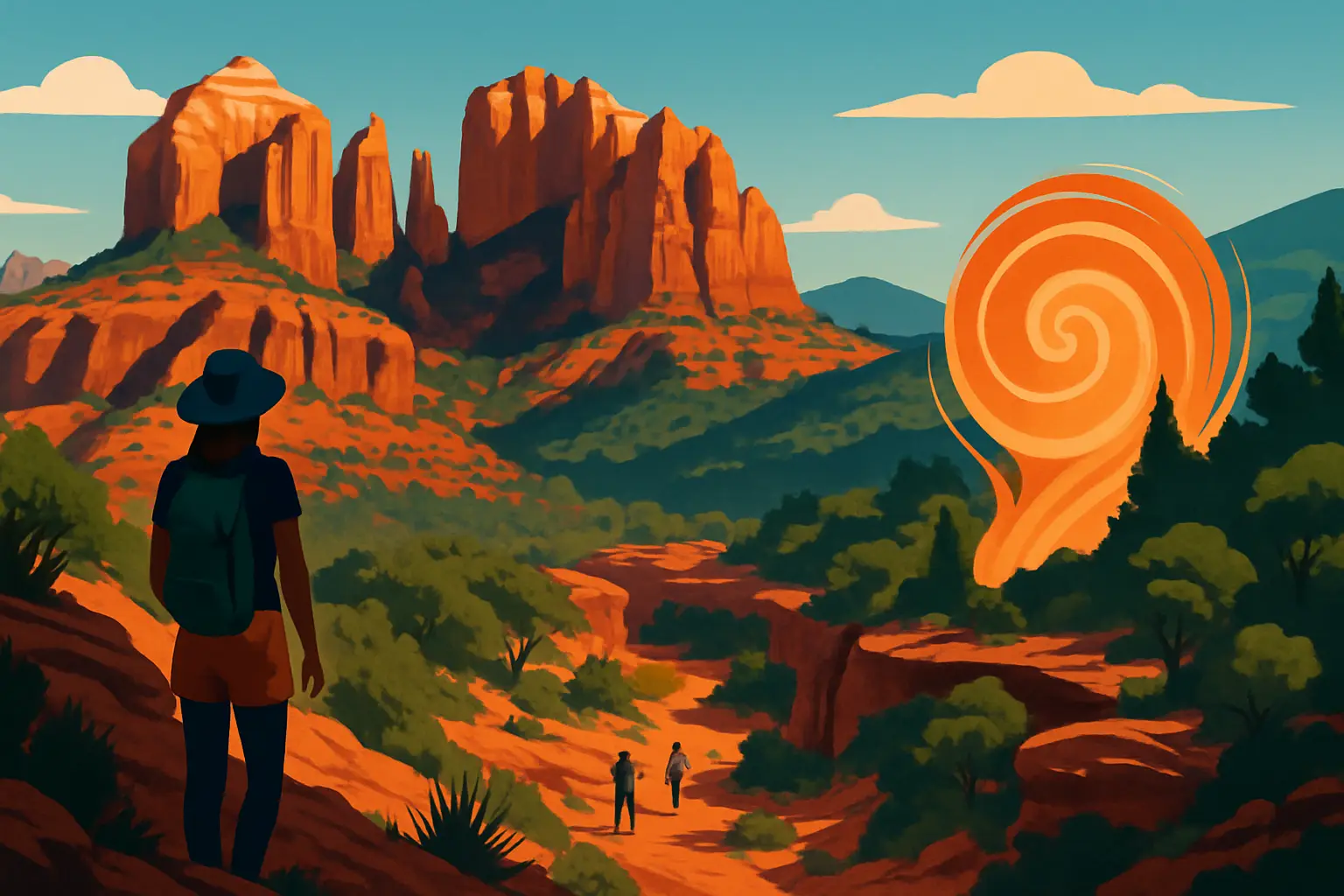
The formations that define Sedona's skyline are made primarily of the Schnebly Hill Formation — a layer of iron-rich sandstone and siltstone deposited approximately 330 million years ago when this region was a broad, shallow coastal desert near the equator. The iron oxide in the rock is literally rust: iron-bearing minerals oxidized over geologic time, turning the stone the distinctive brick-red and orange that makes Sedona look like it's lit from inside at golden hour.
Below the Schnebly Hill Formation, the paler cream-colored layers you can see at the base of many formations belong to the Hermit Formation — slightly older, deposited in a wetter environment that left finer-grained mudstones. Above the red, where formations cap out, you'll often find darker Coconino Sandstone, a wind-deposited layer of ancient sand dunes that shows characteristic cross-bedding visible even from the road on Cathedral Rock.
Oak Creek Canyon, the dramatic gorge running north from Sedona toward Flagstaff on AZ-89A, was carved by Oak Creek over roughly two million years, cutting progressively deeper through these stacked sedimentary layers. The canyon walls are essentially a readable cross-section of 500 million years of geologic history. The rock at the bottom of the canyon — the dark Precambrian basement exposed in some sections — is over 1.7 billion years old. The red rocks at the canyon rim are 300 million years old. You are driving through a time machine every time you take the switchbacks down into the canyon.
Cathedral Rock is Sedona's most photographed formation — four spires rising 1,000 feet above Oak Creek, best seen from the creek crossing at Red Rock Crossing (also called Crescent Moon Ranch State Park). The classic postcard shot is from the creek bed with the formation reflected in the water. Admission to Crescent Moon Ranch is $10 per vehicle.
The Cathedral Rock Trail begins on the opposite side of the formation from Red Rock Crossing — the trailhead is at the end of Back O' Beyond Road off AZ-179. The route covers 1.5 miles round trip with 742 feet of elevation gain in a very short distance. The last section requires scrambling on slickrock with fixed chains for handholds. From the saddle between the spires, you can see across the Verde Valley to the Mingus Mountains. Arrive before 7 a.m. in September to get parking and beat the crowds on the slickrock section, which becomes a slow-moving queue by 9 a.m.
For a much quieter alternative with excellent views of Cathedral Rock from the opposite side, the Baldwin Trail to Templeton Trail loop (7 miles, 800 feet gain) starts near the Red Rock State Park entrance and circles through riparian cottonwood forest along Oak Creek before ascending for the Cathedral Rock views. You'll see almost none of the Cathedral Rock Trail crowd.
Cathedral Rock Trail: Back O' Beyond Road trailhead off AZ-179; 1.5 miles RT, strenuous; Red Rock Pass required
Red Rock Crossing / Crescent Moon Ranch: $10/vehicle; best light is the hour before sunset
Red Rock State Park (Templeton Trail): 4200 Lower Red Rock Loop Rd; $7/vehicle; significantly less crowded than the main Cathedral Rock approach
Get short, interactive stories that make each place easier to remember while you travel.
The Bell Rock Pathway is Sedona's most accessible introduction to the red rock landscape — a paved and gravel trail system in the Village of Oak Creek, about 6 miles south of Sedona's main strip on AZ-179. Bell Rock itself is impossible to miss: a perfectly rounded formation that looks exactly like its name, rising 550 feet above the surrounding scrubland. The basic loop around Bell Rock and adjacent Courthouse Butte covers approximately 4 miles with minimal elevation gain, meaning the views are available to virtually everyone.
Courthousse Butte is the larger companion formation immediately east of Bell Rock. A slightly longer detour encircles it on the Courthouse Butte Loop (3.5 miles), with 360-degree panoramas that include the Mogollon Rim to the north and the valley spreading south toward Cottonwood. In September, the desert scrub here — juniper, pinyon pine, prickly pear, cliffrose — is at its greenest after the summer monsoon season.
The trailhead parking lot off AZ-179 fills by 8:30 a.m. on weekends. An alternate approach is to park at the Visitor Center in the Village of Oak Creek and walk or bike the Bell Rock Pathway from there — the flat path runs directly to the formation, about a mile.
Seven miles north of Sedona on AZ-89A, Slide Rock State Park is a natural waterslide carved into the sandstone of Oak Creek — a 30-foot chute of smooth red rock that funnels swimmers into a series of pools. The park charges $20–$30 per vehicle depending on the day and season (high in summer, lower in fall), and it fills by 9 a.m. on warm September weekends. Arrive early or visit on a weekday.
The water temperature in Oak Creek at Slide Rock runs around 55–65°F year-round — cold enough that most swimmers spend more time on the rocks than in the water. The pool below the main slide is about 6 feet deep at its deepest. The slide itself isn't controlled: the natural current and slight slope do the work, depositing you into the pool. The algae on the rock makes the slide faster than it looks.
For a more secluded Oak Creek experience, West Fork Trail begins 10 miles north of Sedona and follows a side canyon of Oak Creek through canyon walls that narrow to 30 feet wide in places. The 6.5-mile out-and-back crosses the creek fourteen times on stepping stones and logs — in September it's passable in trail runners, though high-top footwear helps with the crossings. The canyon walls rise 200 feet on either side and the canopy of sycamore and box elder starts turning gold in late September, making this trail exceptional in early fall.
The AZ-89A drive through Oak Creek Canyon itself, from Sedona north to Flagstaff, is a 30-mile route through one of the most scenic gorges in Arizona. Flagstaff is 28 miles from Sedona and sits at 7,000 feet — a full day trip gives you red rock country in the morning and ponderosa pine forest for lunch.
Sedona's four recognized vortex sites — Airport Mesa, Cathedral Rock, Bell Rock, and Boynton Canyon — attract visitors who believe the locations emit a swirling energy that facilitates spiritual experiences, meditation, and healing. The vortex phenomenon became widely discussed in the 1980s, partly through the work of Page Bryant, a psychic who identified the specific sites in 1980, and grew substantially as New Age culture intersected with Sedona's tourism infrastructure.
There is no scientific mechanism that supports the energy claims. What the sites do have is geology: each sits on or near prominent sandstone formations that generate strong electromagnetic variation due to the iron content in the rock (iron-bearing minerals respond to magnetic fields), and the elevated terrain creates reliably strong, consistent air currents. Whether these physical properties influence human perception — and whether that perception is meaningful — is a question the geology cannot answer.
What's documentably true is that the vortex sites are among the most beautiful locations in the Sedona area, and the ritual of visiting them — arriving quietly, sitting still, watching the light on the rock — produces something real, whatever you call it. Airport Mesa has a 360-degree panoramic view of the Sedona valley accessible in a 1-mile walk from the Airport Road trailhead. Boynton Canyon requires a 6-mile round-trip hike that passes through Sinagua archaeological sites and a high canyon environment qualitatively different from the open-exposure formations near AZ-179. The hike is worth doing regardless of the vortex designation.
Airport Mesa vortex: Airport Road trailhead, 1 mile RT to the mesa top; best at sunset for panoramic valley views
Boynton Canyon: 6 miles RT, 500 ft gain; trailhead on Boynton Pass Road west of Sedona; quieter and more forested than the southern trail corridors
The Sedona Vortex Society operates a free walking tour map available at the Uptown visitor center — useful for timing and parking logistics regardless of your position on the metaphysics
Sedona's main commercial strip on AZ-89A in Uptown is dense with chain restaurants and tourist-facing operations. These are the places to eat instead.
Elote Café (771 AZ-179, inside the Arabella Hotel) serves elevated Mexican food rooted in Oaxacan and street food traditions. The signature elote — grilled street corn with lime mayonnaise and cotija — is the dish to know the restaurant by. The dining room seats about 70 people and doesn't take reservations; join the waitlist at 5 p.m. when they open (it fills within the first hour). They close when they run out, not at a fixed time.
ChocolaTree Organic Eatery (1595 AZ-89A) has been in Sedona since 2003 and is the right place if you want lunch that reflects Sedona's culture as accurately as its geology does: organic, plant-forward, with a raw cacao bar at the counter and a garden patio under a cottonwood. The cacao ceremony drinks are optional; the açaí bowls and grain salads are genuinely good.
Hideaway Restaurant (251 AZ-179, overlooking Oak Creek) is the answer when you want lunch with a view and don't want to pay resort prices. The covered patio hangs over a bend in Oak Creek with Cathedral Rock visible upstream. The pizza is straightforward, the burgers reliable, and the setting is doing most of the work — but it's doing it well.
For breakfast: the Creekside Coffee & Breakfast on AZ-179 in the Village of Oak Creek is the place locals use before a morning hike — fast, unpretentious, and next to the Bell Rock trailhead parking.
When is the best time to visit Sedona? September through November and March through May are the ideal windows. July and August bring monsoon storms (spectacular but disruptive) and heat over 90°F. December through February is cold at night but trail crowds are minimal and the snow on the red rocks is one of Sedona's best visual moments. September specifically is a sweet spot: summer crowds thin, the heat is manageable, and the monsoon greenery hasn't yet dried out.
How far is Sedona from Phoenix? About 115 miles, typically a 2-hour drive north on I-17 to AZ-179. Flag staff is 28 miles north of Sedona on AZ-89A. Day-tripping Sedona from Phoenix is possible but leaves little time for more than one hike — an overnight stay is strongly recommended. From Flagstaff, Sedona is an easy half-day trip.
Do I need a car? Yes. Sedona has no meaningful public transit. The trailheads, state parks, and restaurants in the Village of Oak Creek are spread across a 10-mile corridor that is not walkable between sites. A rideshare from the main strip to trailheads is possible but expensive ($15–25 per trip) and availability is inconsistent.
Is Sedona expensive? Hotels in the resort zone (Enchantment Resort, L'Auberge de Sedona, Amara Resort) run $300–700 per night. Budget-friendlier lodging exists in the Village of Oak Creek, 6 miles south, at roughly half the resort pricing. Sedona is cheaper to experience than to sleep in — most trails, most views, and the AZ-89A canyon drive are free beyond the trailhead parking pass.
What's near Sedona? Montezuma Castle National Monument is 27 miles south on I-17 — a five-story cliff dwelling built by the Sinagua people around 1100 CE into a natural limestone alcove. Admission is $10. Jerome, a former copper-mining town turned artists' colony, sits 30 miles southwest on a hillside above the Verde Valley and is worth the detour for its Victorian architecture and the vertiginous views from the main street.