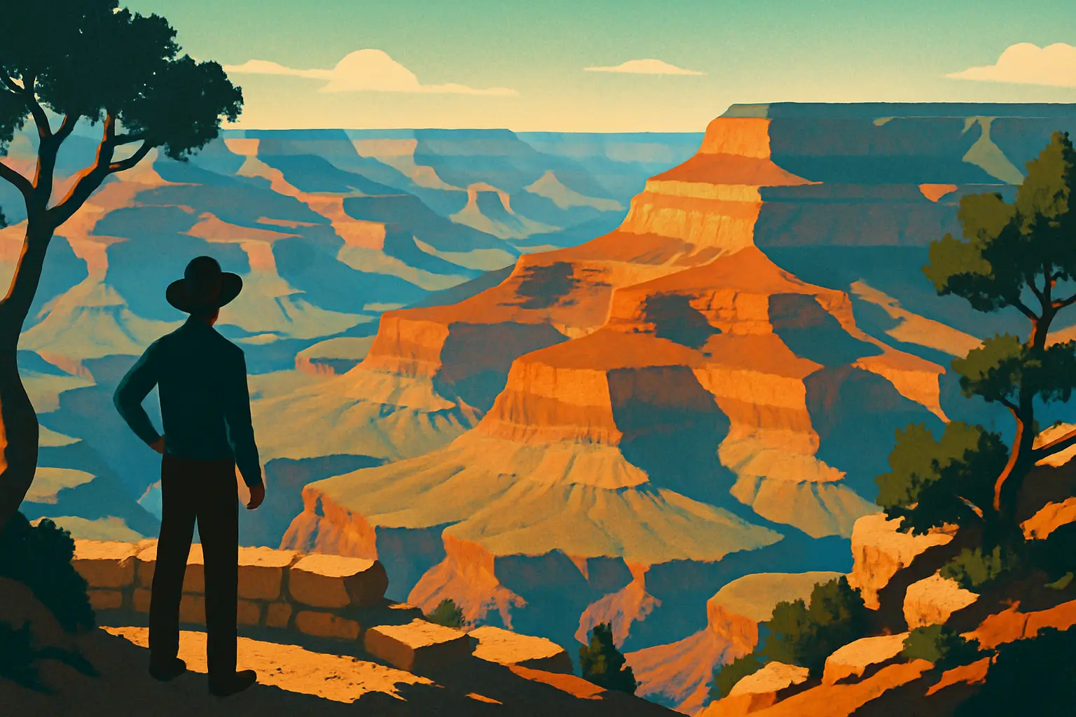
The Grand Canyon did not form because the Colorado River is unusually powerful. It formed because the Colorado Plateau — a roughly 130,000-square-mile block of relatively flat, relatively stable crust covering parts of Arizona, Utah, Colorado, and New Mexico — was uplifted between 5 and 6 million years ago to an average elevation above 5,000 feet, giving the Colorado River the steep gradient it needed to cut downward with unusual speed. Before that uplift, the river meandered sluggishly across a low plain and carved almost nothing.
The plateau's stability is the other half of the equation. Because the Colorado Plateau has experienced far less folding and faulting than surrounding regions like the Basin and Range Province to the south, the rock layers here remained essentially horizontal — stacked in the same sequence in which they were deposited, like pages in an undisturbed book. When the river cut through them, it exposed those layers in cross-section, essentially creating a natural museum display 18 miles wide and a mile deep.
The cutting happened fast, geologically speaking. Most of the canyon's depth was carved in the last 5 to 6 million years — a blink compared to the age of the rocks themselves. The Kaibab Plateau, which the South Rim sits on, sits roughly 1,000 feet higher than the Coconino Plateau to the south, a tilt that directs precipitation northward into the canyon rather than away from it, accelerating erosion. Meanwhile, roughly 11 side tributaries — including Bright Angel Creek and Havasu Creek — carved the canyon's famously complex side canyons, widening it from a slot into the panoramic amphitheater visitors see today.
Understanding this geological setting is essential before examining individual layers, because the Canyon is not just a hole in the ground — it's the result of an extraordinarily specific combination of stable stratigraphy, tectonic uplift, and river incision that almost nowhere else on Earth duplicates.
The rock directly beneath your boots at both the South and North Rim is Kaibab Limestone, a pale cream to yellowish formation roughly 300 to 400 feet thick that dates to approximately 270 million years ago — the Permian Period. Its presence at the rim is one of geology's most vivid teaching tools: this limestone formed at the bottom of a warm, shallow marine sea, yet today it sits at 7,000 feet above sea level. The fossils it contains — brachiopods, crinoids, sponges, and sharks' teeth — are unmistakably marine, confirming that a tropical ocean once covered what is now northern Arizona.
Just below the Kaibab sits the Toroweap Formation, geologically similar (also Permian, also marine) but slightly older and more reddish in tone due to iron oxide content. Together, these two formations represent a transgressive sea — one that advanced inland from the west — and their fossils record the last major marine incursion before the Permian-Triassic extinction event wiped out roughly 96% of marine species worldwide, approximately 252 million years ago.
The Kaibab is exceptionally hard and resistant, which is precisely why it forms the flat rim rather than eroding away. It acts as a caprock, slowing erosion of the layers beneath it. On the rim trail itself, you can spot chert nodules — dark, glassy blobs embedded in the cream-colored limestone — which are silica-rich remnants of ancient sponges. Rangers at the Yavapai Geology Museum can point you to exposed Kaibab outcrops within 50 feet of the main overlook.
Beneath the Toroweap, visible as the first major cliff band below the rim's flat walk, the canyon wall switches to the brilliant white of the Coconino Sandstone — and the ancient environment shifts dramatically from ocean to desert.
Get short, interactive stories that make each place easier to remember while you travel.
The Coconino Sandstone is one of the Grand Canyon's most photogenic and scientifically fascinating layers. Its brilliant white color — almost blinding in direct midday sun — comes from its composition: nearly pure quartz grains, fine and uniformly sorted, cemented together into a cliff face that can reach 350 feet thick. Look closely at exposed sections on the Bright Angel Trail near the 1.5-Mile Resthouse and you'll see cross-bedding: diagonal lines running at angles to the main horizontal layers. Those angled lines are preserved sand dune faces, frozen in stone.
The Coconino formed approximately 275 million years ago during the Permian, when the region sat near the equator and was dominated by a vast inland erg — a sea of sand dunes — similar to the modern Sahara. Wind deposited sand in dunes that migrated, slumped, and were buried, creating the characteristic cross-bedded structure. Geologists estimate the dunes reached heights of 200 to 300 feet, making the ancient desert comparable in scale to the Rub' al Khali of the Arabian Peninsula today.
The Coconino also contains trackways: fossilized footprints of reptiles and amphibians that walked across dune surfaces and were preserved when the next layer of sand buried them before they could erode. These trackways are critically important to paleontology because the animals that made them left no bone fossils in the Coconino — soft sediments don't preserve bones well. The tracks are the only evidence these creatures were here at all. You can see casts of Coconino trackways at the Yavapai Geology Museum without any special permit.
Below the Coconino's white band, the canyon shifts to red and brown — the Hermit Formation, which represents yet another environmental transition, this time to river floodplains and swampy lowlands at the edge of the ancient desert.
No single feature in the Grand Canyon is more intellectually disorienting than the Great Unconformity — and if you can get yourself to the Bright Angel Trail's 3-Mile Resthouse, seeing it in person is one of American geology's great experiences. An unconformity is a gap in the geologic record, a surface where rock layers are missing because they were eroded away or never deposited. The Great Unconformity here represents approximately 1.2 billion years of missing time, making it one of the largest such gaps known anywhere in the world.
At the contact point, you see the brown Tapeats Sandstone (about 525 million years old, Cambrian Period) resting directly on the dark, almost black Vishnu Schist (approximately 1.74 billion years old). Between those two formations, an estimated 12,000 feet of rock that once existed has been completely erased by erosion. The surface between them was once a landscape — likely a coastal plain or tidally influenced shoreline — that was planed flat over hundreds of millions of years before the Cambrian sea advanced and began depositing the Tapeats on top of it.
In some parts of the canyon, the picture is slightly more complex: between the Tapeats and the Vishnu, you can spot remnants of the Grand Canyon Supergroup, a series of tilted Precambrian sedimentary layers between 740 million and 1.25 billion years old that were partially preserved before erosion claimed the rest. These tilted layers — visible as angled bands in the lower canyon walls from overlooks like Desert View Watchtower on the East Rim — look distinctly different from the horizontal layers above them, a visual clue to the enormous geological drama that preceded the Cambrian.
John Wesley Powell, who led the first recorded river expedition through the canyon in 1869, noted the unconformity in his journals without fully understanding its age. Charles Doolittle Walcott, the same scientist who later discovered the Burgess Shale fauna in Canada, conducted the first rigorous study of the Great Unconformity in the Grand Canyon in the 1880s while working for the USGS.
At the very bottom of the inner gorge — the narrow, dark slot that the Colorado River cuts through — the rock changes character entirely. Gone are the horizontal, sedimentary formations with their neat bands of color. In their place are the contorted, swirling dark rocks of the Vishnu Basement Rocks, a collective term for the Vishnu Schist and the Zoroaster Granite that intrudes through it. These are not sedimentary rocks. They are metamorphic and igneous rocks formed deep within a mountain range that no longer exists.
The Vishnu Schist — named for Vishnu Temple, one of the canyon's distinctive buttes — began as marine sediments and volcanic rocks deposited on the ocean floor roughly 1.84 billion years ago. Around 1.74 billion years ago, a massive tectonic collision crumpled those sediments into a mountain chain that may have rivaled the Himalayas in scale. The heat and pressure of deep burial metamorphosed the original rock into schist and gneiss, while pools of molten granite intruded as dikes and plutons — the pale pink and white veins of Zoroaster Granite you see threading through the dark schist in photographs taken from river level.
The resulting rock is extraordinarily hard, which is why the Colorado River is forced into the narrow inner gorge rather than widening it: the granite simply resists erosion far more effectively than the sedimentary formations above. Rafters on the Colorado describe the inner gorge as claustrophobic — walls rising nearly vertical, the sky reduced to a narrow ribbon of blue overhead.
To appreciate the scale: the Vishnu rocks formed more than a billion years before the first animals with hard shells appeared in the fossil record. They predate the Great Oxygenation Event, when photosynthetic bacteria fundamentally transformed Earth's atmosphere. They are among the oldest exposed rocks in North America, and they sit at the bottom of a canyon you can reach on foot in a single strenuous day.
One of the Grand Canyon's most useful geological teaching moments is not what's in the rocks but what's missing. The Cambrian Tapeats Sandstone and its overlying formations — the Bright Angel Shale and the Muav Limestone — contain the first abundant hard-bodied fossils in the canyon: trilobites, brachiopods, and archaeocyathids (an extinct group of reef-forming organisms). These date to roughly 505 to 525 million years ago, during the Cambrian Explosion, when complex animal life diversified rapidly after billions of years of microbial dominance.
Above the Cambrian layers, the fossil record in the canyon becomes spotty. An enormous gap exists in the canyon's sedimentary record between the Cambrian and the Devonian (around 385 million years ago), represented by the Temple Butte Formation — a thin, irregular layer of purple-gray limestone visible only in certain sections of the canyon. The missing Ordovician and Silurian Periods, roughly 100 million years of geological time, were simply never deposited here, or were deposited and eroded.
The Redwall Limestone, one of the canyon's most dramatic visual features — a 500-foot-high vertical cliff face that appears brick red but is actually gray limestone stained by iron oxide washing down from formations above — dates to the Mississippian Period, about 340 million years ago, and is extraordinarily rich in fossils: horn corals, nautiloids, crinoids, and blastoids crowd its surfaces. Paleontologists have documented more than 500 fossil species from the Redwall alone.
Higher in the section, the Supai Group and Hermit Formation — Pennsylvanian and Permian in age — preserve fern fronds, insect wings, and amphibian tracks, evidence of the coal swamp forests that once stretched across what is now the American Southwest. No dinosaur fossils have been found in the canyon walls, not because dinosaurs didn't exist when some of the upper formations were deposited, but because the canyon's Triassic and younger rocks were removed by erosion before the canyon formed.
The Grand Canyon's geology is fully accessible to any motivated visitor, with or without scientific training. The key is choosing the right combination of overlooks, trails, and interpretive resources before you arrive rather than trying to wing it on the day.
Getting there: Grand Canyon National Park's South Rim entrance is at US-64 north of Tusayan, Arizona, approximately 60 miles north of Williams, AZ (off I-40). The park entrance fee is $35 per vehicle, valid for seven days. The North Rim is open mid-May through mid-October and offers a dramatically different perspective on the same formations; entry is via AZ-67 south of Jacob Lake, AZ.
Best geology-specific stops on the South Rim:
**Yavapai Point & Geology Museum** — Free, open daily 8 AM–6 PM (summer). Floor-to-ceiling views with labeled formation chart. Start here.
**Bright Angel Trail to 3-Mile Resthouse** — 4.6 miles round trip, 3,060 ft elevation gain. Crosses the Great Unconformity; passes Kaibab, Toroweap, Coconino, Hermit, Supai, Redwall, Muav, Bright Angel Shale, and Tapeats formations. Allow 4–5 hours. Carry 2+ liters of water per person.
**Desert View Watchtower (East Rim Drive, mile 25)** — Best viewpoint for seeing tilted Grand Canyon Supergroup layers. Free with park admission. Open daily 9 AM–5 PM.
**South Kaibab Trail to Ooh Aah Point** — 1.8 miles round trip, 660 ft elevation. Quick, dramatic views of multiple formation bands with no tree cover. Best at sunrise.
**Ranger geology talks** — Free with admission; schedule posted daily at Yavapai Museum and the Visitor Center near Mather Point. Talks run 30–45 minutes and are tailored to general audiences.