1. What Santorini actually is — a caldera, not just an island
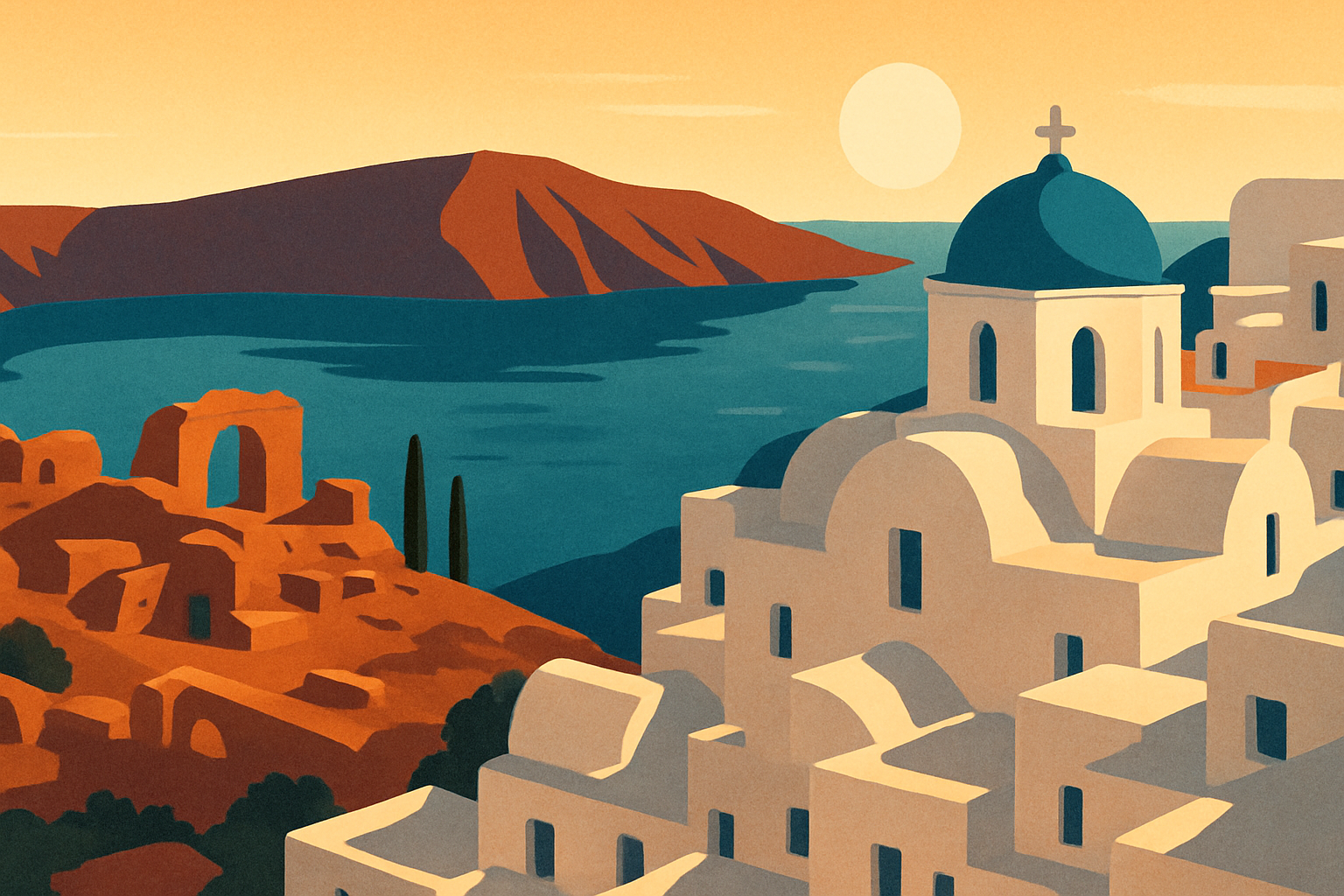
The crescent shape of Santorini is the exposed rim of a volcanic caldera — a magma chamber that partially collapsed into the sea after a catastrophic eruption roughly 3,600 years ago. Before the event, the island was a roughly circular landmass called Thera, inhabited by a sophisticated Minoan community that had built multi-story stone buildings, interior drainage systems, and frescoes depicting dolphins, boxers, and naval expeditions. Around 1600 BCE (dating remains disputed, with estimates ranging from 1627 to 1500 BCE), the volcano erupted with what geologists classify as a Plinian super-eruption — one of the most powerful in the past 10,000 years. The center of the island collapsed into the emptied magma chamber; a resulting wave reached coastlines across the eastern Mediterranean.
What survived is the caldera rim — the arc of cliffs now visible from ferries, rising 200–400 meters above sea level. The western cliff face, covered in white buildings, is a geological cross-section: dark horizontal bands are individual ancient lava flows; pale layers between them are compressed volcanic ash (tephra and ignimbrite). The two small islands visible in the middle of the bay — Nea Kameni and Palea Kameni — are active volcanic vents, born from eruptions in antiquity and as recently as 1950. The volcano is not dormant.
Santorini's official name is Thira (or Thera). The name Santorini is a Venetian-era corruption of 'Santa Irini,' taken from a church and port town. Modern Greeks use Thira almost exclusively.
2. Fira: the capital on the caldera rim
Fira is Santorini's capital and the island's commercial center — it has the bus station, the supermarkets, and most of the mid-range accommodation. The town sits at roughly the midpoint of the western caldera wall, 260 meters above Fira Skala port. The connection between town and port runs three ways: the famous donkey path (an estimated 588 switchback steps), a cable car (€6 each way, opens at 6:30 a.m., runs every 20 minutes in peak season), and the donkeys themselves — though animal welfare campaigns have significantly reduced their use and the cable car is genuinely faster.
Fira is denser and more functional than Oia. The reason to linger here specifically is the Museum of Prehistoric Thera on Mitropoleos Street — a small, well-organized museum housing the finest artifacts recovered from ancient Akrotiri: the celebrated golden ibex figurine, bronze-age storage jars, carbonized food remains, and original fresco fragments. It is dramatically undervisited relative to the island's tourist numbers. Opening hours are 8 a.m. to 8 p.m. in summer; admission €6, or covered by a combined ticket with Akrotiri.
3. Oia: the blue domes, the crowds, and how to find the uncrowded version
Oia (pronounced roughly 'EE-ya') occupies the northern tip of the caldera rim, 11 kilometers from Fira by road. The photographs are accurate: blue-domed churches, white cubic buildings, cascading bougainvillea against deep-blue water. Oia earned its visual reputation entirely.
The crowd problem is equally real. In peak July-August the village can feel like a queue with cafes attached. June is noticeably better — the cruise ship surge that makes Oia nearly impassable in high summer hasn't fully materialized yet.
For the famous sunset, the main platform near the windmill at the northern end of the pedestrian street is mobbed 90 minutes before sundown. The Kastro — the ruined Byzantine-Venetian castle at the very far northwest end of the village — offers the same westward view with a fraction of the density. Walk past the bell tower of Agios Nikolaos church, continue northwest until the buildings stop, and the castle is directly ahead. The ground is uneven; no entry fee.
Ammoudi Bay, 214 steps below Oia cut into the cliff face, is the best lunch option on the island — a handful of fish tavernas built directly on the water at the base of the caldera wall. Book ahead at Sunset Taverna or Dimitris Fish Tavern; in July-August, arriving without a reservation means waiting on the steps.
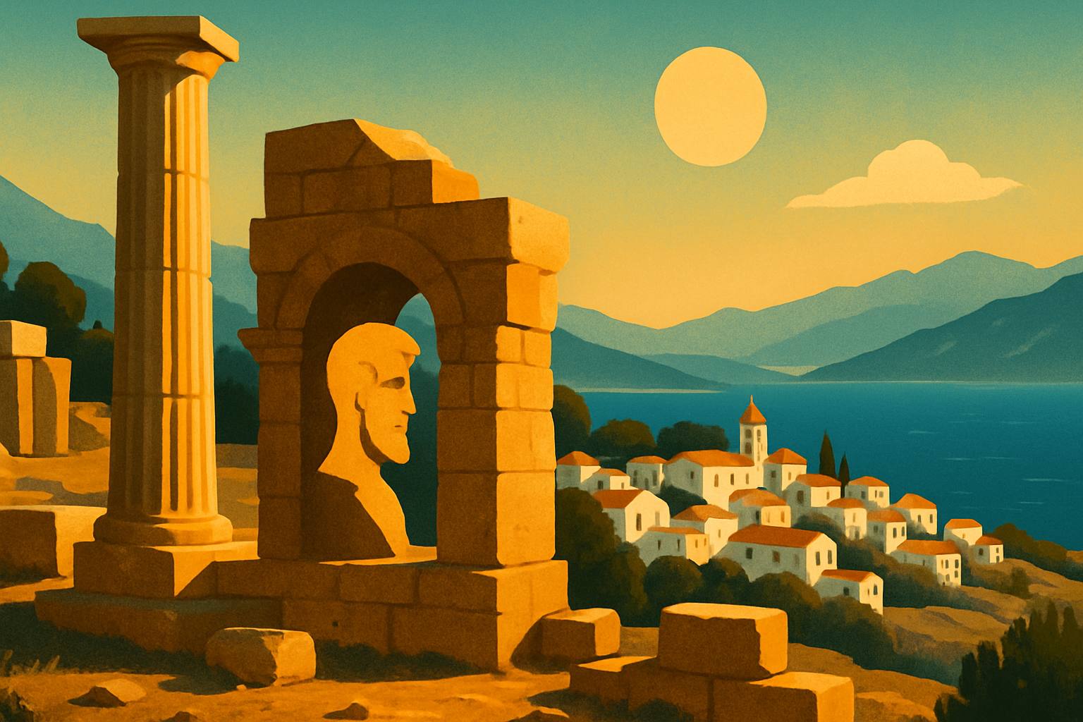
4. Ancient Akrotiri: the Minoan city that volcanic ash preserved for 3,600 years
Akrotiri is one of the most significant Bronze Age sites in Europe, routinely underestimated by visitors who haven't read ahead. The site is a Minoan city buried by the 1600 BCE eruption — comparable to Pompeii, but roughly 1,500 years older. Unlike Pompeii, no human remains have been found: the population apparently evacuated before the final eruption, taking their valuables. The city itself stayed sealed under volcanic ash.
Excavation began in 1967 under archaeologist Spyridon Marinatos. What he found were multi-story stone buildings with staircases intact, paved streets with drainage channels running underneath, storage jars (pithoi) still in position, and painted frescoes that are now among the most celebrated examples of Aegean Bronze Age art. The complete frescoes — depicting dolphins, saffron gatherers, a flotilla of Bronze Age boats — are displayed in the National Archaeological Museum in Athens; the Museum of Prehistoric Thera in Fira holds the best artifacts from the site itself.
The entire excavation is housed under a large modern protective shelter, which makes Akrotiri one of the few ancient sites in Greece that is comfortable to visit during midday heat. The current accessible area represents only a fraction of the full site — the city extends well beyond the shelter's current perimeter and excavation is ongoing. Arriving early (8 a.m. opening) gives you the site in relative quiet before the first tour buses. It is 13 km south of Fira, in the village of Akrotiri; the KTEL bus runs hourly (€2.50), or taxi for €15–18.
5. Santorini wine: Assyrtiko, volcanic soil, and the kouloura vine
Santorini's wine is distinctive enough that it doesn't need the scenery to sell it — though the scenery helps. The indigenous white grape Assyrtiko evolved over centuries on Santorini's volcanic soil: a mix of pumice, ignimbrite, and ash with almost no water-retention capacity, very low rainfall, and intense summer heat moderated by the meltemi wind. The resulting wine has unusually high acidity for a hot-climate grape, a pronounced mineral character often described as saline or chalky, and concentrated citrus notes.
The vines themselves are architectural objects. Because the island's meltemi wind is strong enough to tear apart conventional wire-trained vines, Santorini growers developed the kouloura (basket) method: the vine is trained in a flat spiral coil, growing outward and then curving back down close to the ground in a shape resembling a nest. This keeps the grape clusters inside the basket, protected from wind abrasion. Some kouloura vines on Santorini are estimated at 70–200 years old, among the oldest productive vines in Europe — the root systems drill down through volcanic rock layers to reach groundwater.
Vinsanto, Santorini's sweet wine, is made from sun-dried Assyrtiko and Aidani grapes — laid on rooftops for 8–14 days before pressing, then aged in oak barrels for a minimum of two years. It is one of the few wines in Greece with a genuine aging tradition; bottles from the 1980s and 1990s are still available at some wineries.
Worth visiting: Domaine Sigalas near Oia for guided tastings covering the full range; Hatzidakis Winery in Pyrgos for small-production traditional varieties; Santo Wines on the Pyrgos Kallistis road for caldera-view terraces and a broad portfolio including Vinsanto.
6. Beaches: what 'black sand' means and which beach fits which kind of day
Santorini's beaches have three colors — black, red, and white — and none of them have the pale quartz sand of Mykonos or Paros. The volcanic origin of the island means every beach is made from ground volcanic rock.
Black sand (Perissa, Perivolos, Kamari): The most accessible. Black sand is finely ground volcanic basalt and heats intensely by midday — wear shoes or sandals from sunbeds to waterline in July-August, or the sand will burn your feet. Perissa and adjacent Perivolos form a continuous 6 km beach on the southeast coast, backed by the dramatic Mesa Vouno volcanic rock wall, lined with tavernas and sunbed concessions. The water is clear and the setting genuinely atmospheric. Kamari, on the east coast, is the same material but the beach has a slight curl that makes it calmer for swimming.
Red Beach: A 500-meter coastal path from the Akrotiri archaeological site, or water taxi from Perissa. The cove is small — roughly 100 meters wide — with dramatic rust-red volcanic cliffs shedding debris onto the beach regularly. Rockfalls do occur; the beach is safe to use but the cliffs require awareness. Best visited in the morning before the water taxis arrive.
White Beach: Only reachable by boat — a 5-minute water taxi from Red Beach or from the Akrotiri coastal path. Smaller and quieter still, with pale grey-white volcanic cliffs giving it a completely different quality from the rest of the island.
7. Best time to visit Santorini — and what June specifically offers
June is one of the strongest months to visit. Sea temperature reaches 23–24°C — fully swimmable. Daytime average is 27–28°C, with the afternoon meltemi wind making the heat manageable. Crowds are substantial but noticeably below the late-July and August peak — the cruise ship surge that makes Oia nearly impassable in high summer has not yet arrived at full force. Accommodation prices are still below August peak.
Best overall windows: Mid-May through mid-June, or September into early October. April and October are quieter and cooler; some hotels and restaurants remain closed in April, but those open are better value and the Fira-to-Oia caldera-rim walk (10 km, 3–4 hours) is genuinely pleasant rather than punishing.
July and August: Maximum crowds, maximum prices. Book accommodation 3–4 months in advance minimum. The experience is manageable with planning, but the concentration of people in Oia and on the cable car creates real pinch points.
The Fira-to-Oia trail follows the caldera rim through the villages of Imerovigli and Skaros Rock before reaching Oia. Walk it starting at 6:30–7 a.m. in summer to reach Oia comfortably before the midday heat. The trail is marked, mostly paved, and requires no technical equipment — but the sun exposure on exposed stretches between 10 a.m. and 4 p.m. is severe.
8. How to get to Santorini from Athens
By air: Athens Eleftherios Venizelos (ATH) to Santorini Thira Airport (JTR) is 45 minutes. Aegean Airlines, Olympic Air, and Sky Express operate multiple daily flights in summer; prices range from €50–150 each way depending on timing and advance booking. The airport is in the east of the island near Kamari — 10–12 minutes by taxi (€12–15) to Fira, or €2 by KTEL bus.
By ferry from Piraeus: Two options. Conventional ferries (Blue Star Ferries, Minoan Lines) run the Athens-Santorini route in 8–9 hours — overnight crossings leave Piraeus at around 7:30 p.m. and arrive at Santorini's Athinios port in the early morning, saving a hotel night. Prices run €35–65 for deck class or an economy cabin. High-speed catamarans (Seajets, Golden Star) take 4.5–5 hours but cost €70–120 one way. Both types arrive at Athinios; buses and taxis meet every arrival.
From Athens center, Metro Line 1 (Green Line) to Piraeus station takes about 45 minutes from Syntagma. Book ferry tickets through the operator websites or official Greek ferry aggregators well in advance for July-August — fast boats sell out. The overnight conventional ferry, with a cabin berth and the island visible at dawn on approach, is one of the more reliable Aegean experiences.