1. The sponge diving era: how Kalymnos sent men to the seafloor
For a visitor arriving by ferry into Pothia harbour today, the sponge trade is visible immediately — shops along the quay sell natural sponges in every size, dried golden-brown, hanging from hooks in the same way they have for two hundred years. But the trade that generated them was something else entirely.
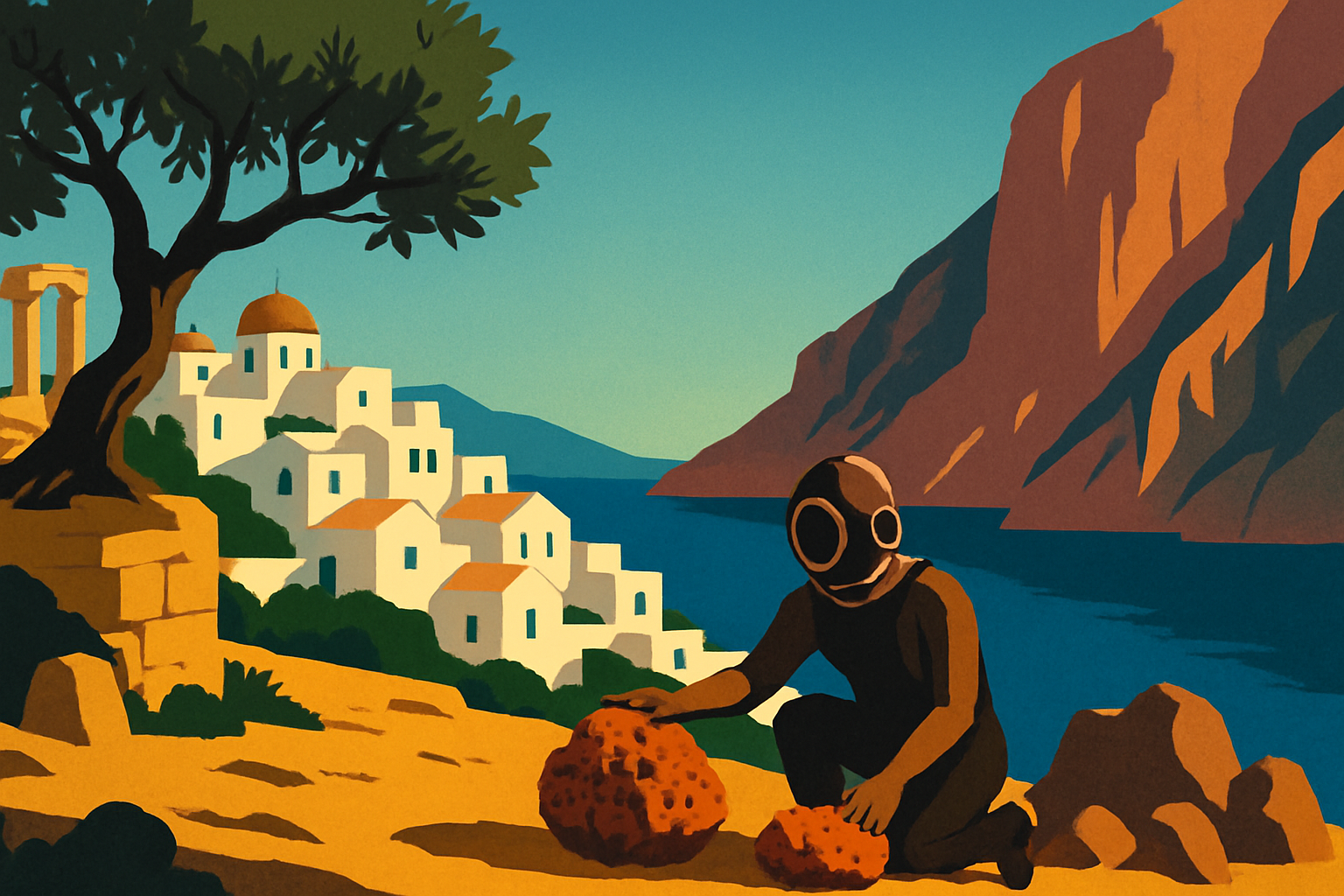
From the early 19th century onward, Kalymnos organized its entire economy around harvesting natural sea sponges from the floors of the Eastern Mediterranean. The divers worked in absolute silence, weighted down by a flat stone called a skandalopetra — typically 15 kilograms — that pulled them under at speed. They held their breath, sometimes for several minutes, and harvested the sponges by hand or with a short blade before releasing the stone and rising. The most experienced men could reach depths of 30 to 40 meters on a single breath.
Each spring, a ceremony called Kataklysmos took place in Pothia's harbour before the fleet departed: priests blessed the diving boats, the men prayed, families gathered on the quay. The boats left for Libya, Tunisia, Egypt, and the waters around Crete and Rhodes. Some men did not return. Decompression sickness — 'the bends', caused by ascending too fast — was poorly understood for most of the 19th century, and it killed and paralyzed Kalymnian divers in large numbers. The island's neoclassical mansions were built on the earnings of men who survived.
The introduction of the fernez suit in the 1860s — an early diving suit — allowed deeper dives but increased the bends dramatically. By some estimates, more than 10,000 divers from the Dodecanese suffered permanent paralysis from decompression sickness between 1870 and 1910. Kalymnos buried the cost in its hillside cemeteries and kept sending boats.
The trade peaked in the first half of the 20th century, then entered a long decline. In 1986, a marine disease destroyed most of the Mediterranean's natural sponge population in a single season. Within a few years, an industry that had structured life on the island for two centuries was effectively finished.
2. The pivot: how rock climbing replaced sponge diving
The limestone massifs that run along Kalymnos' western and southern coast had been there, irrelevantly, through the entire sponge era. They were steep, fractured, and mostly inaccessible — interesting to nobody in particular. Then, in the early 1990s, European sport climbers began to arrive.
The catalyst was largely word of mouth within the climbing community. A small group of Italian and German climbers found that the Kalymnos limestone had unusually high quality: compact, featured, and ideal for the friction-dependent movement of sport climbing. Routes were bolted — permanent metal anchors drilled into the rock at intervals to allow clipped protection — and word spread through the climbing media. By the late 1990s Kalymnos was appearing in European climbing publications. By the 2000s it was internationally established. Today the island has over 3,000 documented routes across more than 70 climbing sectors, at grades ranging from beginner-friendly slabs to overhanging test-pieces attempted by professionals.
The main sectors are clustered around the west-coast villages of Massouri and Myrties. Grande Grotta — a sweeping cave sector above the road below Massouri — is one of the most photographed climbing locations in the world, with its stalactite-hung roof arching over routes that run nearly horizontal before transitioning to vertical. Odyssey sector is larger and more spread, suited to teams wanting variety across a day. The areas around Telendos channel offer afternoon sun when morning sectors are in shadow.
The island's economy reshaped itself around the climbers with striking speed. Guesthouses switched to early-morning breakfast service to allow dawn starts before the heat. Tavernas added drying racks for wet chalk bags alongside their olive trees. The spring departure ceremony — once for sponge boats — became an unofficial marker for the climbing season's opening. The transition was never planned; it was adaptive, and it worked.
3. Pothia: the harbor capital and its neoclassical waterfront
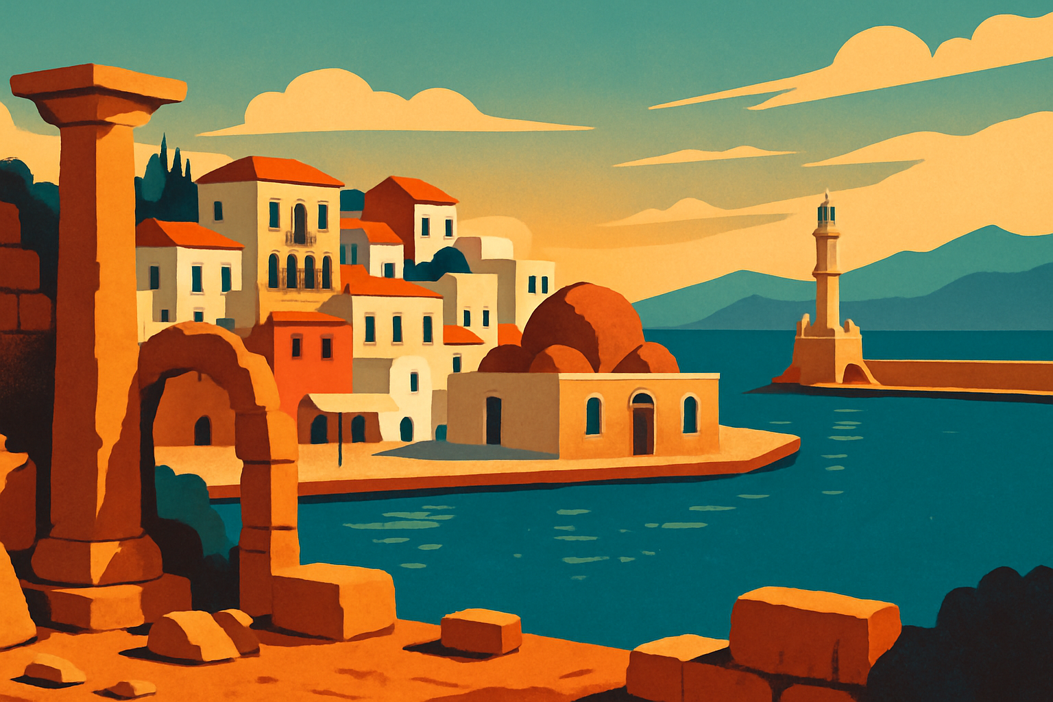
The ferry from Piraeus, Kos, or Rhodes docks in Pothia, the island's capital and only significant city. Unlike the whitewashed Cycladic village architecture that defines Greek island iconography, Pothia is dense, colorful, and explicitly urban — built up the hillside above a sheltered bay, its older neighborhoods studded with neoclassical mansions in ochre and rose and pale blue, the architectural inheritance of the sponge trade's wealthiest generation.
The Kalymnos Maritime Museum on the waterfront is the most concentrated point of entry into the island's diving history. Its collection covers the full arc: skandalopetra diving stones, fernez suit equipment, historic charts of the Mediterranean sponge grounds, photographs of the pre-departure ceremonies, and testimony from divers who survived the bends. The museum is organized over four rooms and takes about 90 minutes to move through properly; the upper floor has a view across the harbour from which the original departure angle of the fleet is visible.
Along the Pothia quayside itself, several workshops still process natural sponges — cleaning, trimming, and grading the dried forms for sale. These are genuine working operations, not tourist reconstructions. You can watch the process from the shop fronts. The sponges sold here come primarily from Caribbean and Pacific sources today, since Mediterranean stocks never fully recovered; the few local divers who still work do so for niche collectors.
Kastri Hill rises immediately above the port with the ruins of the Great Castle — a Byzantine fortress built in 1495 that served as the medieval capital of Kalymnos until 1812. The climb is 230 steps from the port and the view over Pothia's rooftops and the bay beyond earns the effort. Bring water; there is none at the top.
4. Myrties, Massouri, and the west coast
The west coast road from Pothia to Myrties and Massouri takes about 20 minutes by scooter or car and crosses the island's central ridge before dropping toward the sea. The transition is immediate: on the Pothia side, the landscape is dry and rocky; on the west coast, the villages sit on a narrow strip between the limestone massifs and the channel separating Kalymnos from Telendos.
Myrties is the lower of the two linked villages, sitting at water level around a small beach and the jetty where water taxis cross to Telendos. Its main street is a brief strip of kafeneions, small hotels, and diving equipment shops. The beach is pebbled, the swimming clean, and the setting — Telendos filling the view across a 800-meter channel — is the visual signature of this part of the island.
Massouri is immediately above, built slightly higher on the hillside and more oriented toward the climbing community. The cafes along its main street open early — by 6:30 a.m. — to allow climbers to eat before the first light reaches the sectors. In October and April, the outdoor seating fills with people comparing route sheets and discussing the morning's climbing. In July, the same seats fill later with swimmers who have no interest in limestone.
Between Massouri and the sectors above it, a short but steep walk reaches the base of Grande Grotta — roughly 15 minutes on foot from the village. The cave is immediately recognizable from any Kalymnos climbing photograph: a concave amphitheater of overhanging stone with stalactites hanging from the roof and bolted lines running out along near-horizontal features. Non-climbers can walk to its base and look up; the scale of the overhang — and the distant figures moving across it — is striking in a way that requires no technical knowledge to appreciate.
5. Vathy Valley: the fjord that grew citrus trees
On the eastern side of Kalymnos, completely separate from the climbing coast, is Vathy — a narrow, steep-walled valley that opens from an inland lake to a tiny port called Rina at its seaward end. The Vathy Valley is consistently described as unlike anything else in the Greek islands, and for once the comparison holds: the valley walls rise almost vertically on both sides, creating a light-cut canyon whose proportions recall Norwegian fjords more than Aegean island geography.
The valley floor is cultivated — mandarin and lemon groves have been worked here for centuries, irrigated by springs that make this the most fertile land on an otherwise dry island. The trees are dense enough to block the sky in places. Walking the valley road in spring, the citrus scent is heavy and persistent in a way that contrasts sharply with the barren ridge country ten minutes above.
Rina itself is a working fishing harbor with a church, a taverna, a beach of round stones, and a small anchorage where pleasure boats from Rhodes and Kos occasionally put in. The ferry from the main island to Vathy runs infrequently; the correct way to arrive is by scooter or car from Pothia (about 15 km of winding road), though caique boat trips from Myrties harbor can include Vathy in a day-long coastal circuit.
The valley is quietest early in the morning before tour groups from organized excursions arrive between 10 and 11 a.m. Going in the morning and leaving before noon gives you the valley to yourself — the citrus groves, the vertical walls, the harbour at the end — without sharing it.
6. Telendos: the island that split off in 554 AD
In 554 AD, an earthquake separated Telendos from Kalymnos, cutting through what had been a continuous ridge and leaving a small triangular massif sitting 800 meters offshore. The channel between them is calm, shallow, and easy to read from the Myrties jetty — you can see Telendos' houses clearly from the mainland shore.
The water taxi from Myrties runs continuously from approximately 8 a.m. to midnight and costs €2 each way. The crossing takes five minutes. There are no cars on Telendos — not banned, simply unnecessary. The island is small enough to walk completely in two hours.
On Telendos, the main activities are three: swimming from the Paradise Beach pebble cove on the far side of the island (20 minutes' walk from the jetty), eating at one of the three small tavernas, and climbing. Several sectors on Telendos are among the most scenic on the island, with routes looking out over the Kalymnos channel. The ruined Byzantine castle on the southern ridge — reached by a rough path from the jetty — adds a silhouette to the evening skyline that appears in most west-coast sunset photographs.
Sunset from Telendos — looking east across the channel at the Kalymnos ridgeline catching the last light — is objectively the best view in the immediate area. The tavernas facing the channel have chairs arranged to face it. The sunset dinners are a local institution: catch the last light, eat grilled fish, take the last water taxi back around 10 or 11 p.m. No one is in a hurry on Telendos, which makes it the island's most effective decompression chamber.
7. Is Kalymnos good for non-climbers? And when should you go?
Is Kalymnos worth visiting if you don't climb? Yes, without qualification. The climbing community has built out the island's tourism infrastructure so thoroughly that the incidental benefits — good accommodation, early-opening cafes, high-quality tavernas, reliable ferry connections — apply to everyone. The beaches on the west coast (Myrties, Massouri) and east coast (Vlyha, Emborios) are uncrowded by Greek island standards because the island self-selects for climbers over beach tourists. Pothia's maritime history, Vathy's fjord landscape, and Telendos' car-free afternoons have nothing to do with climbing and are some of the island's strongest attractions.
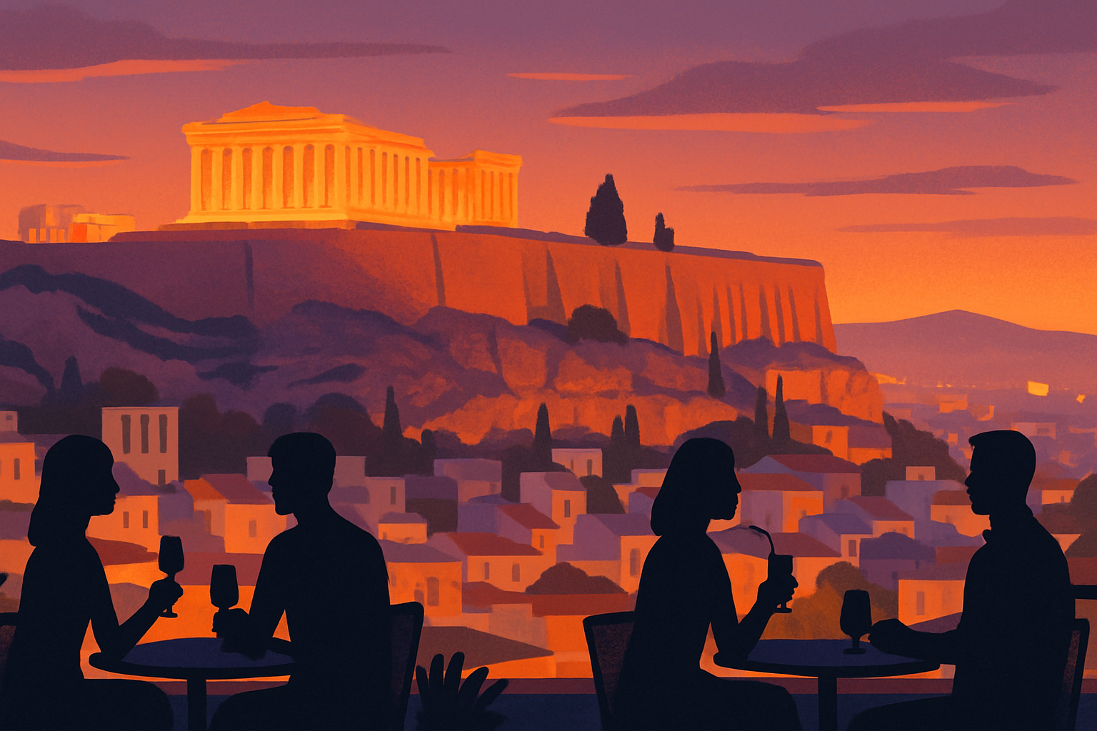
Best time to visit Kalymnos? Spring (April–June) for climbing and hiking with green hillsides and mild temperatures. October for the climbing festival and clear seas. July and August for swimming-focused visits — the climbing sectors are too hot but the beaches, Vathy, and Telendos are in full operation. The island is quieter in summer than Santorini or Mykonos by a significant margin because it draws a different traveler. For a neighbor island comparison, Kos is 20 minutes by ferry and runs as a complete contrast: beach resort town, party scene, package tourism. Kalymnos is the Dodecanese island for people who want to do something more specific.
How to get to Kalymnos? From Athens' Piraeus port: an overnight Blue Star Ferries crossing (approximately 10 hours) with regular departures. From Kos: a short ferry connection (20–40 minutes depending on service). From Rhodes: a longer hop north through the Dodecanese chain (4–5 hours). Kalymnos has a small airport with limited domestic connections; most visitors arrive by sea. The ferry schedule increases significantly from May through October. Pothia harbour is the arrival point for all vessels. Patmos is also reachable from the same ferry line, sitting two stops north.