1. What the Pueblos Blancos are — and why they are white
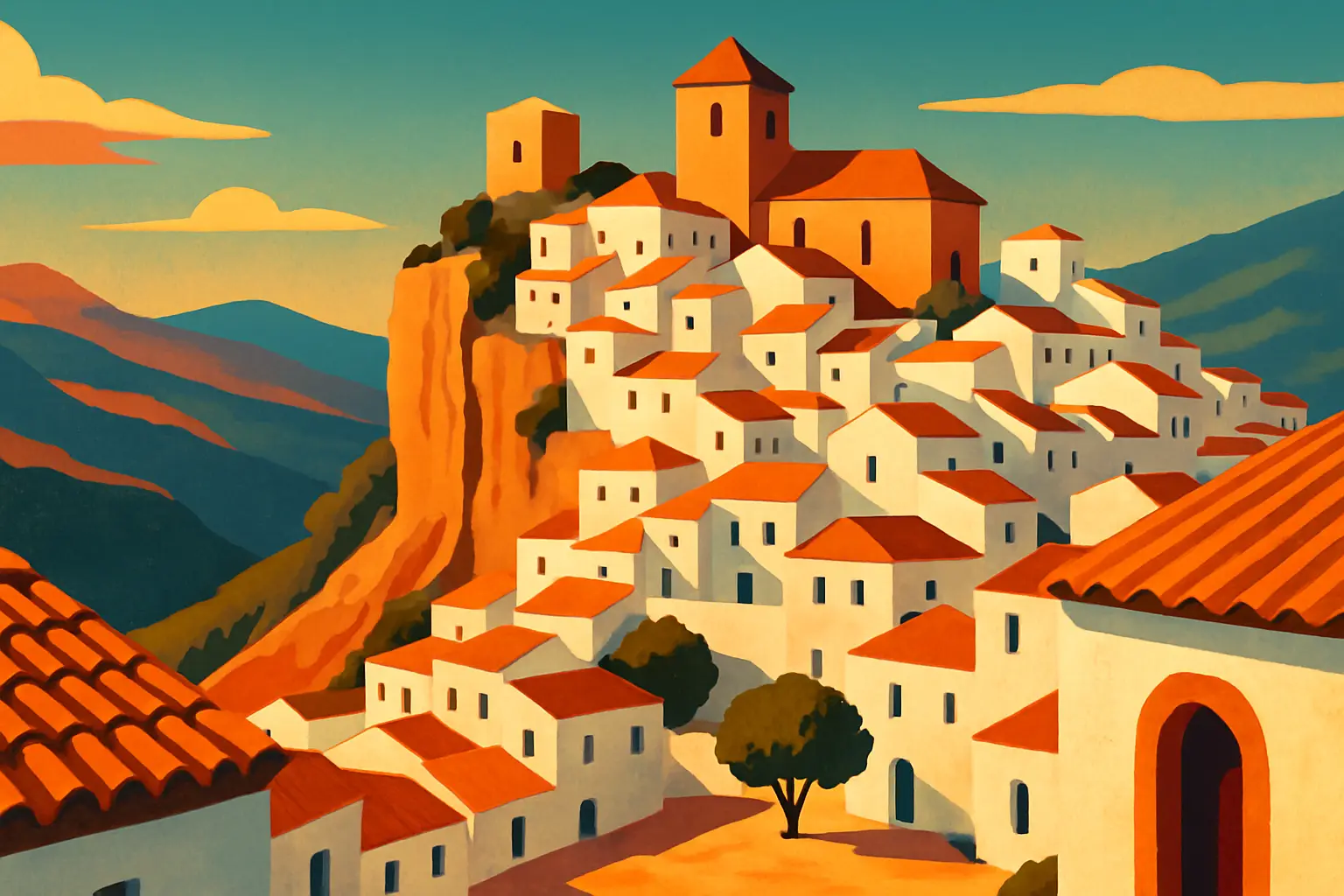
The term Pueblos Blancos (White Villages) refers most precisely to a group of roughly 19 villages in the Sierra de Cádiz, in the Cádiz and Málaga provinces of western Andalusia. They share three things: whitewashed walls, dramatic hilltop or clifftop positions, and origins that trace directly to the Reconquista — the 700-year military campaign during which Christian kingdoms from the north gradually retook the Iberian Peninsula from Muslim rule, a process that ended in 1492 when the Nasrid kingdom of Granada fell to Fernando and Isabel.
The name suffix you will see on nearly every village — de la Frontera — is the key to understanding why they exist where they exist. It means 'of the frontier,' and it marks each village as a border settlement: a place that sat, for centuries, directly on the contested boundary between Christian and Muslim Spain. Arcos de la Frontera, Jerez de la Frontera, Zahara de la Frontera (as Zahara was sometimes called) — these were not picturesque retreats. They were military outposts, changing hands repeatedly, fortified and reinforced with each change of ruler.
The whitewash itself has a practical origin. Lime (cal), slaked from limestone abundant throughout the Sierra de Cádiz, was applied to exterior walls across the Islamic Mediterranean world — it is a powerful antiseptic, it reflects heat and lowers interior temperatures significantly, and it is cheap to reapply. In the summers when Andalusia hits 38–42°C in the valleys, a lime-washed stone building stays 8–12°C cooler inside than an uncoated one. The Moors brought the practice; the Christians who inherited the buildings kept it; it became culturally identified with Andalusia so thoroughly that it is now maintained by local ordinance in most of these villages.
2. Arcos de la Frontera: the gateway perched 96 meters above the Guadalete
The most logical entry point to the Pueblos Blancos route is Arcos de la Frontera, 31km east of Jerez de la Frontera and 64km northeast of Cádiz. The old town — the casco histórico — sits on a narrow limestone ridge 96 meters above the Guadalete River, and from the ridge you can see in three directions across the river valley for 20–30km. That visibility was exactly why the Moors fortified it; the name Arcos likely derives from the Arabic 'Arkos,' though the Romans had a settlement here called Arunda before that.
The town changed hands several times during the Reconquista before the Castilian king Alfonso X took it definitively in 1264. The Castillo de los Duques — the castle of the Arcos dukes — occupies the highest point of the ridge. It is privately owned and cannot be entered, but its exterior walls, integrated directly into the cliff face, are visible from the Plaza del Cabildo, the old town's main square, where the cliff drops nearly vertically to the riverbank.
The Basílica de Santa María de la Asunción on Plaza del Cabildo is a Gothic-Mudéjar church begun in the 15th century and not completed until the 18th. The west façade is carved in the Plateresque style — the intricately detailed, silver-work-like stonework developed in Spain between the Gothic and Renaissance periods. The church's choir stalls are 16th-century carved walnut, worth seeing if the church is open (hours vary; try between 10 a.m. and 1 p.m.).
The best experience in Arcos requires no ticket: walk Calle Escribanos from Plaza del Cabildo to the cliff-edge Mirador del Pueblo — a small terrace where the town ends and the valley begins. Go at sunset. The Guadalete reservoir below catches the color; the white village behind you does the same. It is one of the best views in Andalusia.
3. Zahara de la Sierra and Grazalema: a pivotal siege, a turquoise reservoir, and Spain's wettest village
Forty kilometers northeast of Arcos, the village of Zahara de la Sierra sits above the brilliant turquoise water of the Zahara-El Gastor reservoir, a Moorish castle tower visible from 10km away on the approach road. The name comes from the Arabic 'zahara,' meaning flower — the village was in Muslim hands for most of the period when this part of Andalusia was in play, and its capture and recapture are a microcosm of the Reconquista's volatility.
In 1481, the Nasrid king of Granada staged a surprise winter raid and seized Zahara from the Castilians — an event that infuriated the Spanish monarchs Fernando and Isabel enough to accelerate their final military campaign against Granada. The village was retaken by the Castilians in 1483. The Castillo de Zahara, the 12th-century Almohad watchtower at the summit of the crag, is a 20-minute climb from the village plaza and gives a 360-degree view across the Sierra de Grazalema Natural Park. The climb is steep and unsignposted; wear shoes with grip and go in the morning before the August heat sets in.
Grazalema, 12km north of Zahara along a road that winds through the limestone sierra, is the wettest village in Spain — a fact that surprises most visitors standing in Andalusian sunshine until they understand the geography. The Sierra de Grazalema acts as a barrier that catches Atlantic moisture rolling in from the Gulf of Cádiz; the village receives an average of 2,100mm of rain per year, the highest recorded total in the Iberian Peninsula. The moisture that falls as rain on Grazalema falls as drought on the Almería coast 200km east.
This microclimate produces specific things worth knowing about. The forests above Grazalema contain pinsapo firs (Abies pinsapo), a pre-Ice Age relict species that survived in this specific mountain range and in the Rif Mountains of Morocco — nowhere else in the world. The trees look like dense, perfectly conical Christmas trees 20–30 meters tall; access to the pinsapo forest requires a free permit from the park visitor center at Avenida de la Diputación, 1. The village is also the origin of the manta de Grazalema — wool blankets woven since 1792 using Merino sheep bred in the surrounding sierras, sold at the original Payoyo factory on Calle Agua, 49.
4. Setenil de las Bodegas: seven failed sieges and a village built under a cliff
Setenil de las Bodegas is the most visually extraordinary of the Pueblos Blancos — a village where, on two parallel streets, residential buildings and tapas bars are built directly into the overhanging rock of the Río Trejo gorge, using the cliff face itself as the ceiling and back wall. This is not a cave town in the Cappadocia sense; it is a conventional village where some streets happen to run under a rock overhang so substantial that the buildings required no roof on two sides. The result is a streetscape that looks physically impossible until you are standing in it.
The name Setenil is thought to derive from the Latin Septem Nihil — 'seven times nothing' — a reference to the seven failed Christian attempts to take the village from the Moors before it finally fell in 1484. The natural defensive advantage is immediately obvious on arrival: the gorge walls make direct assault from below impossible, and the village controlled the only passage through the gorge on this route through the Sierra. It was among the last of the Sierra de Cádiz villages to fall during the Reconquista, just eight years before the final surrender of Granada in 1492.
The two cave streets are Calle Cuevas del Sol (which faces south and catches direct sunlight) and Calle Cuevas de la Sombra (which faces north, stays in shadow, and is 3–4°C cooler). Both are lined with a continuous facade of white-painted buildings — restaurants, tapas bars, residential houses — pressed against and under the rock. Bar Cueva El Puente on Calle Cuevas del Sol is the best-known and most frequently photographed, but the quality of food is consistent across most of the establishments on both streets. Order the pringá (a slow-cooked pulled pork spread served on bread), which is a speciality of this corner of Cádiz province, and the torta de aceite (olive oil flatbread) made with Setenil's locally pressed oil.
5. Olvera and the greenway south: the balcony of the Pueblos Blancos
Olvera, 20km north of Setenil along the A-382, is often called the 'balcony of the Pueblos Blancos' — a marketing phrase that is, for once, accurate. The town of 8,000 people sits on a limestone spur above the olive-covered plain of the Guadalquivir basin, and from the Iglesia Parroquial de Nuestra Señora de la Encarnación at the top of the town — a neoclassical church built between 1803 and 1843 on the site of the former mosque — the view extends across the white rooftops below and then to the sierra beyond. The church's clock tower serves as the visual anchor of the Olvera skyline visible from the approach roads.
Olvera's other claim to significance is the Vía Verde de la Sierra — a 36km cycling and walking greenway built on the bed of an abandoned railway line that would have connected Olvera to Jerez de la Frontera. Construction of the railway began in 1929, employed thousands of workers through the Depression, bored 30 tunnels through the sierra, and then stopped in 1936 at the outbreak of the Spanish Civil War and was never resumed. The line was converted into a greenway in 2001, and the infrastructure it left behind — viaducts, tunnels, and station buildings now converted into rural guesthouses — makes it one of the most architecturally interesting cycling routes in Spain. The greenway begins at the Olvera rail station on Calle Nuestra Señora de los Remedios, which is also where bike rentals are available.
For those not cycling, the Castillo Árabe de Olvera (the Moorish castle above the town) is open for visits Tuesday through Sunday, 10 a.m. to 2 p.m. and 4–6 p.m. Admission is €2. The castle retains its original Almohad defensive tower and command tower from the 12th century, and the climb through the castle interior provides the clearest explanation you will find anywhere on the route of how Moorish military architects used natural topography.
6. Vejer de la Frontera: where the route meets the Atlantic
The southernmost of the major Pueblos Blancos, Vejer de la Frontera sits 200 meters above the Costa de la Luz — the Atlantic coast of Cádiz province — on a Moorish hilltop that commands views to the sea on clear days. Of all the white villages on the route, Vejer has the most distinctly Moorish street plan: the medina-like lanes of the casco histórico follow the curved, interlocking logic of a medieval Islamic city rather than the Roman grid pattern common in Andalusian lowland towns. The Arabs called it Besher; the name Vejer may derive from the Latin 'vetera' (old) or from the Visigothic placename that preceded it.
The village is known for the cobija — a traditional black shawl worn by Vejer women that covered the face except for one eye, a practice maintained into the 1930s and documented in photographs that resemble veiled Moroccan street dress more than anything from mainland Spain. The cobija is now a cultural symbol rather than a worn garment, featured in the town's annual festivals.
Practically, Vejer is the best base if you plan to combine the inland route with time on the Costa de la Luz coast. The beach at El Palmar, 11km southwest on the CA-2225 road, is a wide, relatively uncrowded Atlantic beach with consistent surf. Zahara de los Atunes, 18km south, is named for the bluefin tuna that once passed through the strait in enormous seasonal migrations; the town's almadraba (tuna trap) fishing operation dates to Roman times and still functions, though the catches are now tightly regulated. Vejer's old town restaurants — particularly El Jardín del Califa on Plaza de España, 16, which serves Moroccan-inflected Andalusian cooking in a converted 18th-century palace courtyard — make it the best place on the route for a proper dinner.
7. How to plan the route: car, timing, and the question of a guide
A car is not an option for this route — it is a requirement. The villages are connected by mountain roads (the A-372, A-382, A-2300, and CA-3312) that have no public bus service between them beyond Arcos and Jerez de la Frontera. Rental cars are cheapest from Jerez Airport (XRY), which is served by direct flights from London, Amsterdam, Brussels, and Frankfurt. Driving from Jerez to Arcos takes 35 minutes; from Arcos to Setenil, about 50 minutes via Zahara and Grazalema.
The natural sequence is: Arcos de la Frontera → Zahara de la Sierra → Grazalema → Setenil de las Bodegas → Olvera → (south via A-384) → Vejer de la Frontera. This covers roughly 180km of driving spread across 2–3 days comfortably, or 3–4 days if you hike the Grazalema sierra or cycle the Vía Verde.
The Reconquista history that shaped these villages is dense, and a guided tour of even one village adds enormous context. Several agencies based in Jerez (including Real Tours Jerez, operating from Calle Lealas, 2) run day tours from Jerez or Seville that cover two or three villages with an English-speaking guide; expect to pay €50–€75 per person. For the independently minded, the Sierra de Grazalema Natural Park visitor center in Grazalema (Avenida de la Diputación, 1) has the best free printed route maps in English.
•**Best starting point from major cities:** From Seville, Arcos is 92km southeast via the A-4 and A-382 (about 1 hour). From Málaga, Setenil is the closest entry point via the A-45 and A-382 (75km, just over 1 hour). From [Cádiz](/es/blog/cadiz-old-town-complete-guide), Vejer de la Frontera is 53km north on the CA-2225 (45 minutes).
•**Fuel and provisions:** Fill up in Arcos or Olvera — the mountain roads between villages have no petrol stations. Most villages have at least one small supermarket, but stock up on water before the Grazalema-to-Setenil mountain stretch.
•**GPS accuracy:** Mountain roads have frequent tunnels that lose satellite signal. Download the Google Maps route to your phone offline before leaving Arcos.
8. When to go, what to budget, and the August question
The honest answer to 'when should I visit the Pueblos Blancos' is: not in peak summer unless you plan carefully. July and August see daytime temperatures in the valley towns — Arcos, Olvera — reaching 38–42°C by early afternoon. The mountain villages (Grazalema, Zahara) are 8–12°C cooler than the coast, which makes them more manageable, but the hiking and castle climbing that reward this route are genuinely difficult in midday August heat.
If you are visiting in August (as many travelers are), structure your days around the heat: village exploration and castle visits before 11 a.m., lunch in the shade of Setenil's cave streets between 1 and 4 p.m., and late afternoon and evening activities after 6 p.m. The villages feel entirely different after 7 p.m. when locals emerge for the evening paseo and the light on the whitewashed walls turns deep orange.
September is widely considered the best month for this route: summer crowds thin, temperatures drop to the low 30s, the reservoirs are still full, and village festivals (particularly the Fiestas Patronales of Grazalema in late August/early September) add local color without overwhelming the streets.
•**Daily budget (mid-range, per person):** €60–€90 covers accommodation in a casa rural, two meals, entry fees, and petrol for a shared car. The route is considerably cheaper than comparable scenic drives in France or Italy.
•**Best value accommodation:** Casas rurales (licensed rural guesthouses) throughout the Sierra de Cádiz cost €45–€70 for a double room and frequently include breakfast. Book at least three weeks ahead for August.
•**What to skip:** The 'Ruta de los Pueblos Blancos' signage in the villages is inconsistently maintained — some signs point to minor villages (Villaluenga del Rosario, Benaocaz) that are worth a drive-through but rarely justify a stop unless you are specifically interested in rural ethnography or have extra time.
•**Photography note:** Photographing the villages from a distance requires stopping on the approach roads. The best exterior views of Arcos are from the Mirador de Matavacas on the opposite bank of the Guadalete (cross the river at Bornos and head north on the A-393); for Zahara, the reservoir viewpoint on the A-2300 approach from El Gastor gives the classic castle-above-water shot.
•**What to buy:** Grazalema's Payoyo cheese and wool blankets are the most distinctive local products. Olvera produces excellent organic olive oil (look for Aceites Torre Miguel, sold in the local cooperative on Avenida Nuestro Padre Jesús). Setenil's artisan pork products — particularly the cured morcilla (blood sausage) and salchichón — are outstanding and travel well.